MyTopo
Belews Lake North Carolina US Topo Map
Couldn't load pickup availability
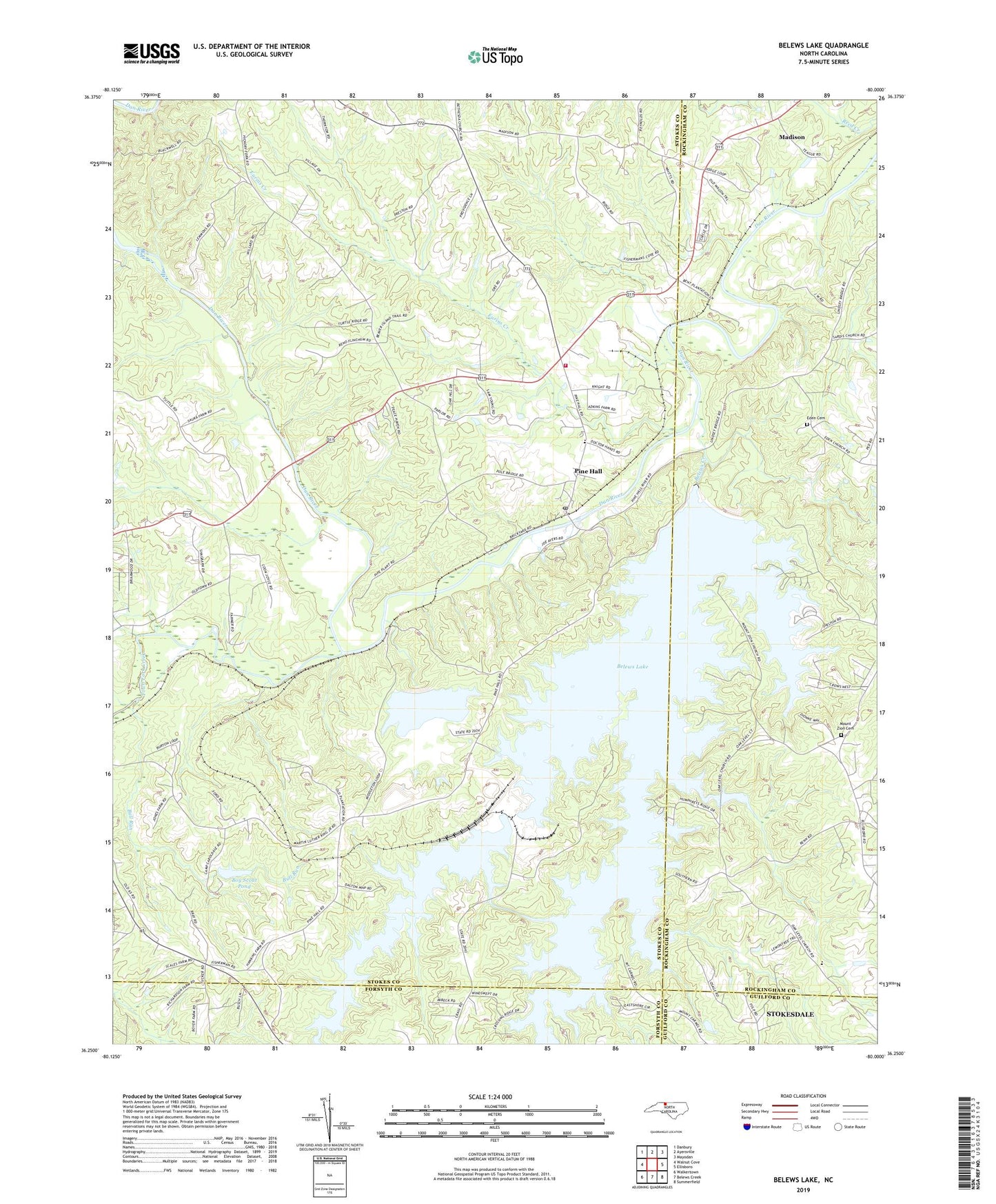
2022 topographic map quadrangle Belews Lake in the state of North Carolina. Scale: 1:24000. Based on the newly updated USGS 7.5' US Topo map series, this map is in the following counties: Stokes, Rockingham, Forsyth, Guilford. The map contains contour data, water features, and other items you are used to seeing on USGS maps, but also has updated roads and other features. This is the next generation of topographic maps. Printed on high-quality waterproof paper with UV fade-resistant inks.
Quads adjacent to this one:
West: Walnut Cove
Northwest: Danbury
North: Ayersville
Northeast: Mayodan
East: Ellisboro
Southeast: Summerfield
South: Belews Creek
Southwest: Walkertown
This map covers the same area as the classic USGS quad with code o36080c1.
Contains the following named places: Anderson House, Belews Creek, Belews Creek Dam, Belews Lake, Boy Scout Pond, Boy Scout Pond Dam, Bull Run, Camp Vaughn, Ceramic, Chisman, Dry Hollow Church, East Walnut Cove Community Park, Eden Cemetery, Eden United Methodist Church, Eurins Creek, Fellowship Church, Forest Chapel, Grace Baptist Church, Hairston Plantation, Hariston, Morning Star Baptist Church, Mount Carmel United Methodist Church, Mount Zion Cemetery, Mount Zion United Methodist Church, Oak Level Church, Open Door Church, Paynes Mill, Pine Hall, Pine Hall Cross Roads, Pine Hall Elementary School, Pine Hall Missionary Baptist Church, Pine Hall Post Office, Pine Hall Presbyterian Church, Pine Hall United Methodist Church, Riverview Golf Course, Rock Hill Baptist Church, Sharps, Stokes - Rockingham Volunteer Fire and Rescue Station 1, Stonewood Acres, Sycamore Baptist Church, Tarheel Fish Farm, Town Fork Creek, Township of Sauratown, West Belews Creek, Withers Chapel United Methodist Church, ZIP Code: 27042