MyTopo
Diggs North Carolina US Topo Map
Couldn't load pickup availability
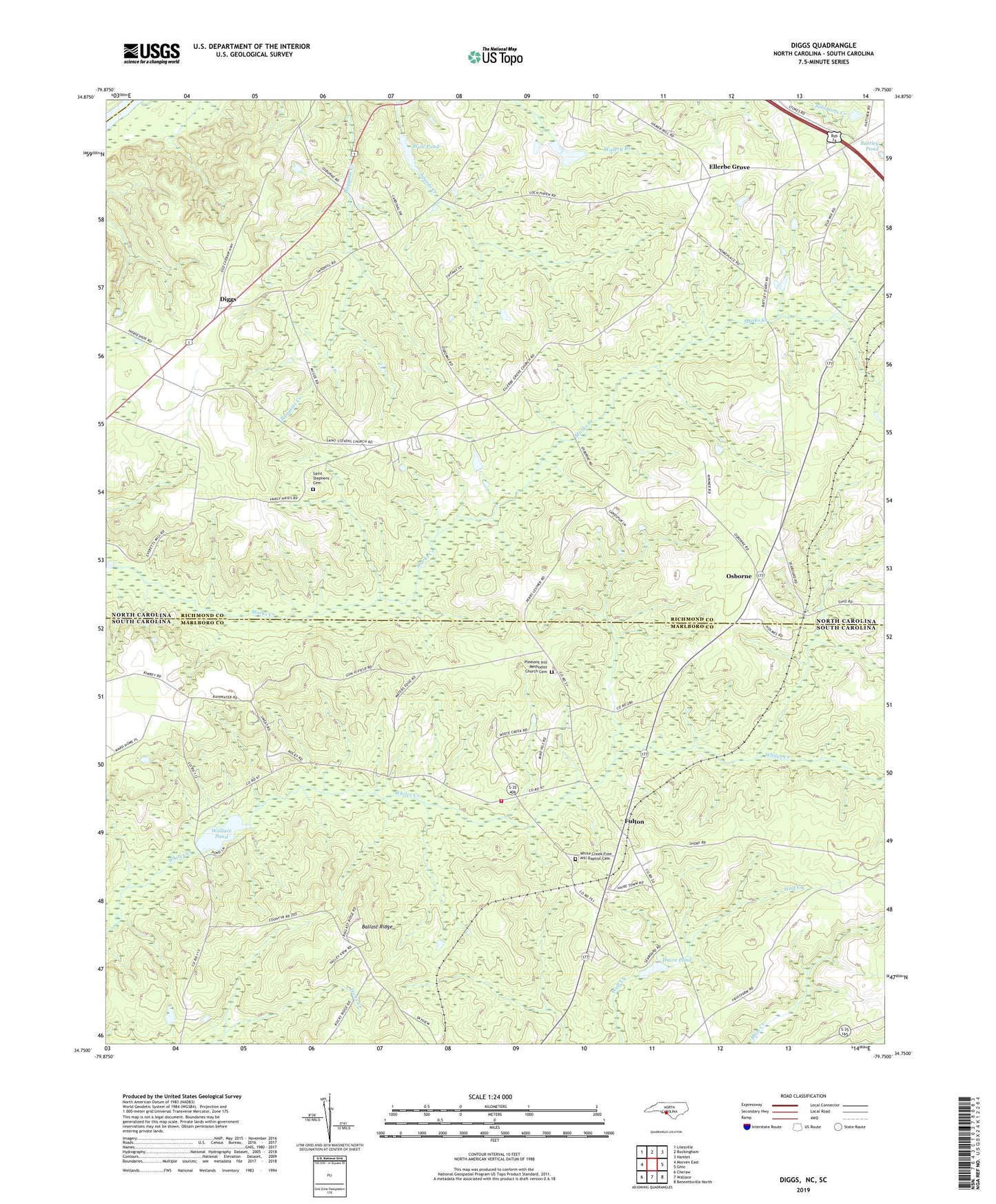
2022 topographic map quadrangle Diggs in the states of North Carolina, South Carolina. Scale: 1:24000. Based on the newly updated USGS 7.5' US Topo map series, this map is in the following counties: Richmond, Marlboro, Anson. The map contains contour data, water features, and other items you are used to seeing on USGS maps, but also has updated roads and other features. This is the next generation of topographic maps. Printed on high-quality waterproof paper with UV fade-resistant inks.
Quads adjacent to this one:
West: Morven East
Northwest: Lilesville
North: Rockingham
Northeast: Hamlet
East: Ghio
Southeast: Bennettsville North
South: Wallace
Southwest: Cheraw
Contains the following named places: Ballast Ridge, Ballast Ridge Lookout Tower, Diggs, Ellerbe Grove, Everette Mill Pond, Faith Missionary Church, Fulton, Gillespies Pond, Haire Pond, Haire Pond Dam D-3431, Little Mountain, Osborne, Palmetto Creek School, Pleasant Grove Church, Pleasant Hill Church, Pleasant Hill Methodist Church Cemetery, Saint Pauls Church, Saint Stephens Cemetery, Saint Stephens Church, Sawyers Mill, South Carolina Noname 35001 D-3426 Dam, Township of Wolf Pit, Wall Pond, Wall Pond Dam, Wallace Fire Department - Haire Town Station, Wallace Pond, White Creek Free Will Baptist Cemetery, White Creek School, Whites Creek Church