MyTopo
Osbornville North Carolina US Topo Map
Couldn't load pickup availability
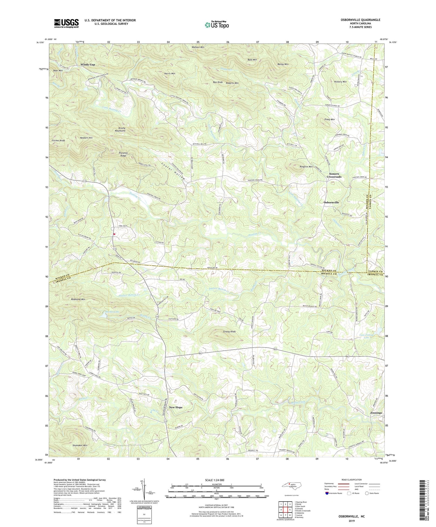
2022 topographic map quadrangle Osbornville in the state of North Carolina. Scale: 1:24000. Based on the newly updated USGS 7.5' US Topo map series, this map is in the following counties: Wilkes, Iredell, Yadkin. The map contains contour data, water features, and other items you are used to seeing on USGS maps, but also has updated roads and other features. This is the next generation of topographic maps. Printed on high-quality waterproof paper with UV fade-resistant inks.
Quads adjacent to this one:
West: Gilreath
Northwest: Roaring River
North: Ronda
Northeast: Elkin South
East: Brooks Crossroads
Southeast: Harmony
South: Central
Southwest: Hiddenite
This map covers the same area as the classic USGS quad with code o36080a8.
Contains the following named places: Bailey Mountain, Bald Mountain, Bear Branch, Bear Mountain, Bee Knob, Brushy Creek, Bussels Creek, Cass Dam, Cass Fishing Lake, Clercy Branch, Cooter Hollow, Dishmon Creek, Dugger Creek, Fitches Knob, Friendship Church, Grassy Knob, Grassy Knob Church, Harris Mountain, Hickory Mountain, Jennings, Johnson Dam, Little Hunting Creek, Lovelace, Mathis Dam, Mathis Lake, Mount Calvary Church, Mount Pisgah Church, Mountain View Church, Nesbert Hill, New Castle, New Hope, Noname, Osborn Creek, Osbornville, Pasture Bottom Creek, Piney Mountain, Prevette Ridge, Redmond Mountain, Ringfire Mountain, Roberts Mountain, Sam Branch, Shady Grove Church, Shumaker Mountain, Smyths Chapel, Somers Crossroads, Sweet Home Church, Taylor Springs Baptist Church, Templeton Store, Township of New Hope, Township of Somers, Union Church, Wallace Mountain, Wilkes - Iredell Volunteer Fire Department, Windy Gap, Zimmerman, Zion, ZIP Code: 28689