MyTopo
Mangum North Carolina US Topo Map
Couldn't load pickup availability
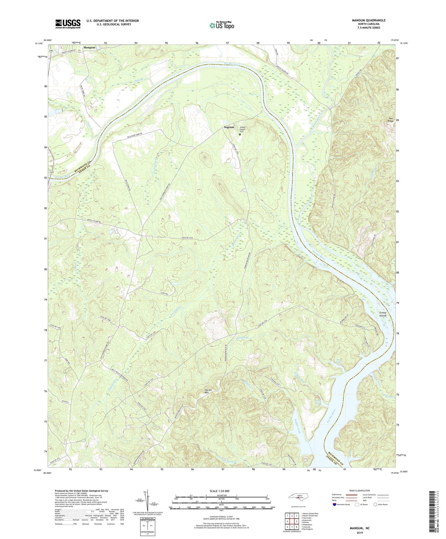
2022 topographic map quadrangle Mangum in the state of North Carolina. Scale: 1:24000. Based on the newly updated USGS 7.5' US Topo map series, this map is in the following counties: Anson, Richmond. The map contains contour data, water features, and other items you are used to seeing on USGS maps, but also has updated roads and other features. This is the next generation of topographic maps. Printed on high-quality waterproof paper with UV fade-resistant inks.
Quads adjacent to this one:
West: Ansonville
Northwest: Mount Gilead West
North: Mount Gilead East
Northeast: Harrisville
East: Ellerbe
Southeast: Rockingham
South: Lilesville
Southwest: Wadesboro
This map covers the same area as the classic USGS quad with code o35079a8.
Contains the following named places: Bell Pond, Big Mountain Creek, Buffalo Creek, Cedar Creek, Colemans Creek, Dry Creek, Fall Branch Church, Grassy Islands, Hebron Church, Ingram, Ingram Mountain, Ingram School, Jenkins Branch, Joseph Ingram Cemetery, Little River, Lookout, Mangum, Mount Zion Church, Naked Creek, Old Smith Ferry, Old Stanback Ferry, Olivet Church, Pee Dee, Petty Gulf, Reeder Branch, Rocky Mount Church, Savannah Church, Savannah Creek, Slink Branch, Turkey Top Creek