MyTopo
Ellisboro North Carolina US Topo Map
Couldn't load pickup availability
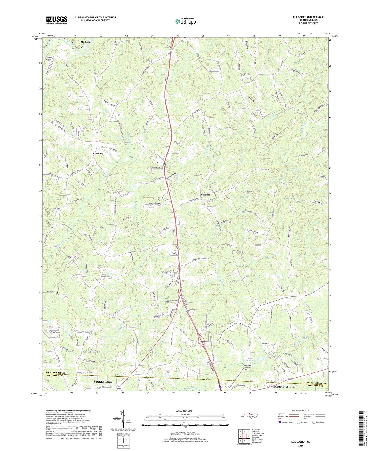
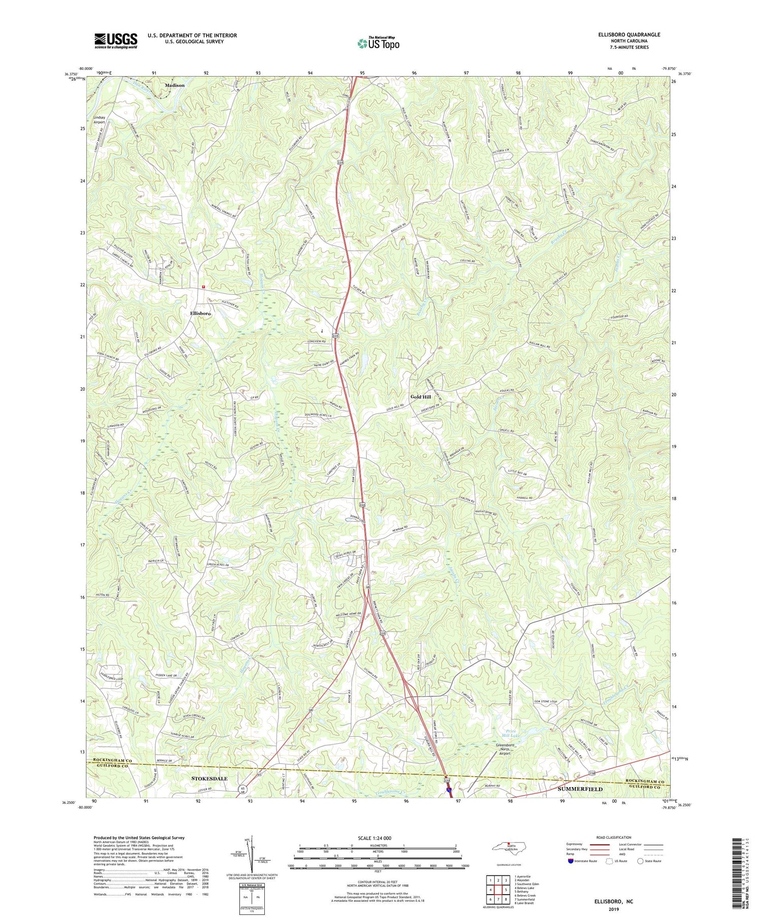
2019 topographic map quadrangle Ellisboro in the state of North Carolina. Scale: 1:24000. Based on the newly updated USGS 7.5' US Topo map series, this map is in the following counties: Rockingham, Guilford. The map contains contour data, water features, and other items you are used to seeing on USGS maps, but also has updated roads and other features. This is the next generation of topographic maps. Printed on high-quality waterproof paper with UV fade-resistant inks.
Quads adjacent to this one:
West: Belews Lake
Northwest: Ayersville
North: Mayodan
Northeast: Southwest Eden
East: Bethany
Southeast: Lake Brandt
South: Summerfield
Southwest: Belews Creek
Contains the following named places: Baldhill Church, Big Beaver Island Creek, Brushy Creek, Comers Chapel, Ellisboro, Ellisboro Church, Gideon Church, Gold Hill, Greensboro North Airport, Hayes Chapel, Hogans Creek, Huntsville Volunteer Fire Department, Intelligence, Kallam Grove Church, Liberty Wesleyan Church, Lindsay Airport, Mount Bethel Church, Mount Tabor Church, New Hope Church, New Light Church, Palestine Church, Price Mill Lake, Price Mill Lake Dam, Reed Creek, Sardis Church, The Little Country Church, Township of Huntsville, Township of New Bethel, ZIP Code: 27357