MyTopo
Lake Brandt North Carolina US Topo Map
Couldn't load pickup availability
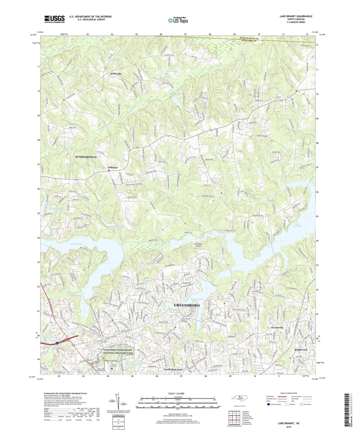
2023 topographic map quadrangle Lake Brandt in the state of North Carolina. Scale: 1:24000. Based on the newly updated USGS 7.5' US Topo map series, this map is in the following counties: Guilford, Rockingham. The map contains contour data, water features, and other items you are used to seeing on USGS maps, but also has updated roads and other features. This is the next generation of topographic maps. Printed on high-quality waterproof paper with UV fade-resistant inks.
Quads adjacent to this one:
West: Summerfield
Northwest: Ellisboro
North: Bethany
Northeast: Reidsville
East: Browns Summit
Southeast: McLeansville
South: Greensboro
Southwest: Guilford
This map covers the same area as the classic USGS quad with code o36079b7.
Contains the following named places: Air Harbor Airport, Bass Chapel, Battle Forest, Brightwood, Brightwood School, Britt-Fishman Lake, Britt-Fishman Lake Dam, Camp Carlson, Carter Lake, Carter Lake Dam, Center Church, Country Park Acres, Forest Lawn Cemetery, Foster Lake, Foster Lake Dam, Gethsemane Church, Greensboro Country Park Lake Five A, Greensboro Country Park Lake Five A Dam, Greensboro Country Park Lake Five B, Greensboro Country Park Lake Five B Dam, Greensboro Fire Department Station 14, Greensboro Fire Department Station 2, Greensboro Fire Department Station 41, Greensboro Fire Department Station 43, Greensboro Fire District 13 Station 13, Greensboro Waterworks, Guilford County Fire Station 58 Fire District 13, Guilford Courthouse National Military Park, Hillsdale, Hillsdale Church, Hillsdale Lake Dam, Hillside Lake, Horsepen Creek, Hunsucker Lake Dam, Hunsuckle Lake, Jefferson Club Lake, Jefferson Standard Country Club Dam, Jesse Wharton School, Joyner Memorial Church, Koontzville, Lake Brandt, Lake Brandt Church, Lake Brandt Dam, Lake Jeanette Dam, Lake Townsend, Lees Chapel, Long Branch, Martin Avenue Church, Mears Fork, North Church Plaza, North Hills, North Hyde Park, Northeast Guilford Volunteer Fire Department Station 33, Reedy Fork Church, Richardson Lake, Richardson Lake Dam, Richland Creek, Richland Lake, Robins Nest Lake, Robins Nest Lake Dam, Saint Pauls Church, Scalesville, Spicewood, Summerfield Fire Department Scalesville Station 29, Summerfield Fire District Battle Ground Station 39, Summit Hills, The Orchard, Thomas Chapel, Three Meadows, Township of Center Grove, Wayside Church, White Oak Heights, ZIP Code: 27455