MyTopo
Summerfield North Carolina US Topo Map
Couldn't load pickup availability
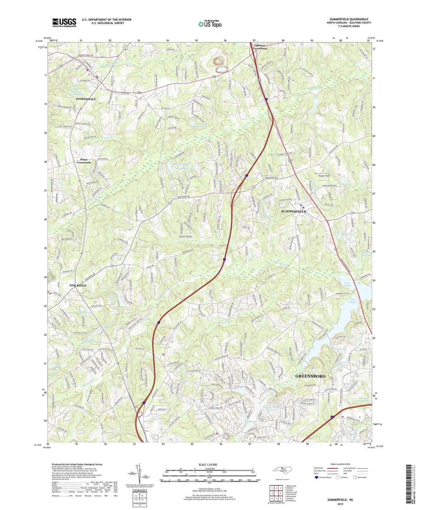
2022 topographic map quadrangle Summerfield in the state of North Carolina. Scale: 1:24000. Based on the newly updated USGS 7.5' US Topo map series, this map is in the following counties: Guilford. The map contains contour data, water features, and other items you are used to seeing on USGS maps, but also has updated roads and other features. This is the next generation of topographic maps. Printed on high-quality waterproof paper with UV fade-resistant inks.
Quads adjacent to this one:
West: Belews Creek
Northwest: Belews Lake
North: Ellisboro
Northeast: Bethany
East: Lake Brandt
Southeast: Greensboro
South: Guilford
Southwest: Kernersville
This map covers the same area as the classic USGS quad with code o36079b8.
Contains the following named places: Bailes Old Mill Dam, Bailes Old Millpond, Barricks Dam, Barricks Lake, Beaver Creek, Brush Creek, Cardinal Country Club Dam, Cardinal Country Club Lake, Carlson Farms Lake, Carlson Farms Lake Dam, Central Church, Collins Grove Church, Fairview Church, Flat Rock Church, Foglemans Lake, Foglemans Lake Dam, Foster Dam, Foster Lake, Greensboro Fire Department Station 17, Greensboro Fire Department Station 21, Guilford County Fire Station 51, Hardin Lake, Hardin Lake Dam, Henson Lake, Henson Lake Dam, Her-La-Co Park, Hobbs Lake, Hobbs Lake Dam, Honkers Hollow Dam, Honkers Hollow Lake, Hopewell Church, Jessup Grove Church, Kings Crossroads, Lake Higgins, Lake Higgins Dam, Lambert Dam, Lambert Lake, Laughlin School, Lenio Dam, Linville Dam, Linville Lake, Martin Lake, Martin Lake Dam, Meylor Field, Moores Creek, Moravia Church, Morehead Church, New Hope Church, Northwest Church, Northwest Junior High School, Northwest Senior High School, Oak Ridge, Oak Ridge Elementary School, Oak Ridge Fire Department Station 15, Oak Ridge Post Office, Ogburns Crossroads, Pleasant Ridge Church, Rock Branch, Ski Lake, Ski Lake Dam, Stokesdale, Stokesdale Elementary School, Stokesdale Fire Department Station 12, Stokesdale Post Office, Stokesdale Quarry, Summerfield, Summerfield Elementary School, Summerfield Fire District Station 9, Summerfield Post Office, Town of Oak Ridge, Town of Stokesdale, Town of Summerfield, Township of Bruce, Township of Oak Ridge, Waynick Lake, Waynick Lake Dam, Whitaker Lake, Whitaker Lake Dam, Wood Lake, Wood Lake Dam, ZIP Codes: 27310, 27358