MyTopo
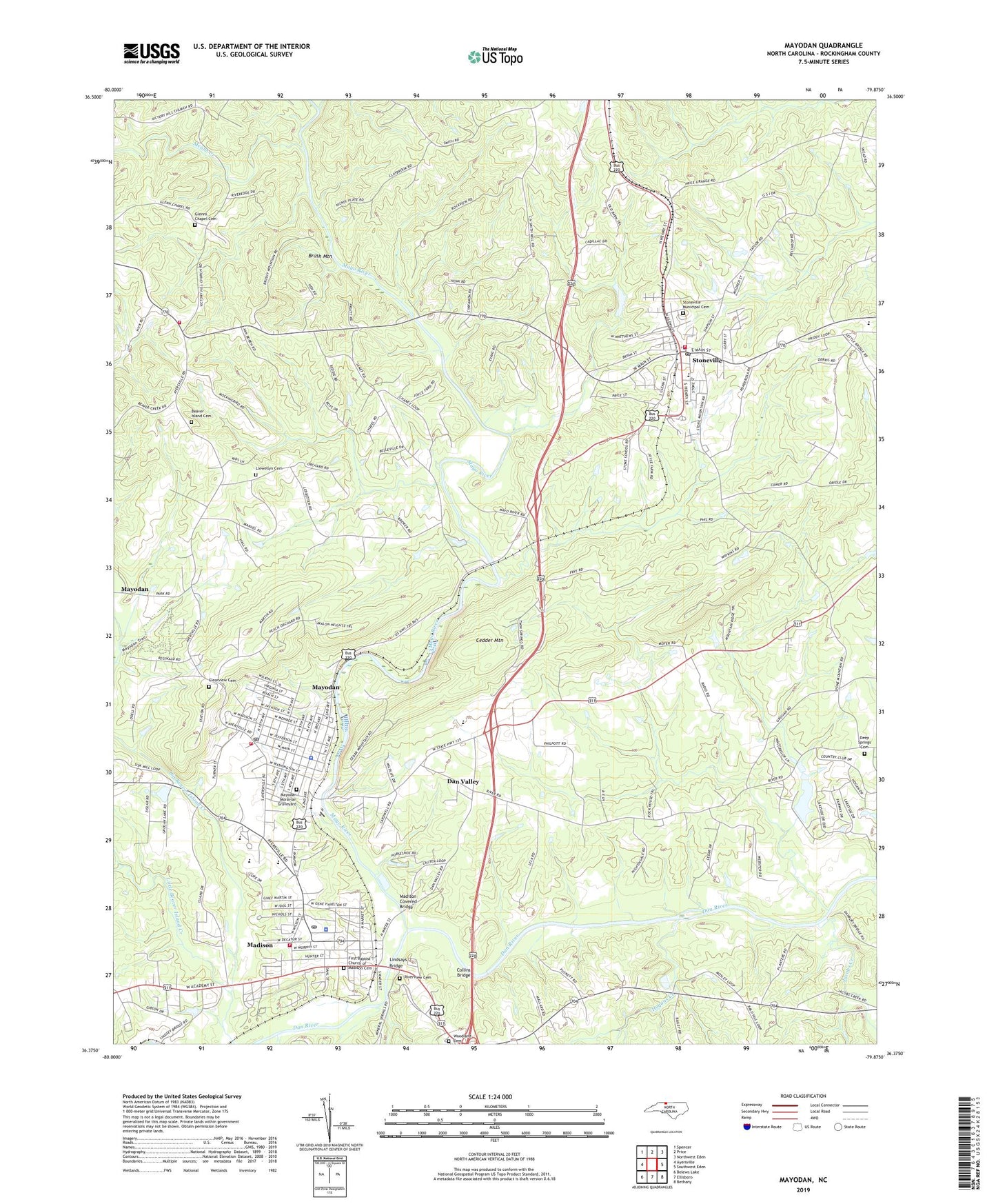
Mayodan North Carolina US Topo Map
Couldn't load pickup availability
2022 topographic map quadrangle Mayodan in the state of North Carolina. Scale: 1:24000. Based on the newly updated USGS 7.5' US Topo map series, this map is in the following counties: Rockingham. The map contains contour data, water features, and other items you are used to seeing on USGS maps, but also has updated roads and other features. This is the next generation of topographic maps. Printed on high-quality waterproof paper with UV fade-resistant inks.
Quads adjacent to this one:
West: Ayersville
Northwest: Spencer
North: Price
Northeast: Northwest Eden
East: Southwest Eden
Southeast: Bethany
South: Ellisboro
Southwest: Belews Lake
This map covers the same area as the classic USGS quad with code o36079d8.
Contains the following named places: Avalon Dam, Beaver Island, Beaver Island Baptist Church, Beaver Island Cemetery, Brush Mountain, Cedder Mountain, Clearview Baptist Church, Clearview Cemetery, Collins Bridge, Dan Valley, Dan Valley Baptist Church, Dan Valley Golf Club, Danbury Plantation, Deep Springs, Deep Springs Baptist Church, Deep Springs Baptist Church Cemetery, Deer Springs Country Club Estates, Elliot Duncan Elementary School, Episcopal Church of the Messiah, First Baptist Church of Madison, First Baptist Church of Madison Cemetery, First Baptist Church of Mayodan, First Baptist Church of Stoneville, Glenns Chapel Cemetery, Glens Chapel, Grogan Estate Lake, Grogan Estate Lake Dam, Hogans Creek, Idol Park, J C Lassiter School, Jacobs Creek, John W Dillard Elementary School, Joyce Chapel Presbyterian Church, Joyce School, Kellam School, Lakeview Baptist Church, Lindsays Bridge, Little Beaver Island Creek, Llewellyn Cemetery, Madison, Madison - Rockingham Rescue Squad, Madison Covered Bridge, Madison Fire Department, Madison Police Department, Madison Post Office, Madison Presbyterian Church, Madison-Mayodan High School, Madison-Mayodan Junior High School, Martin View Church, Mayo Airport, Mayo River, Mayodan, Mayodan Camp, Mayodan Fire Department, Mayodan Moravian Graveyard, Mayodan Police Department, Mayodan Post Office, Mayodan Public Library, Means Creek, Mid-Town Plaza, Mount View Estates, Northwest Rockingham Fire Department, Pawpaw Creek, Pentecostal Holiness Church, Riverview Cemetery, Rockingham Square Shopping Center, Scott School, Stone Junior High School, Stone Mill Estates, Stoneville, Stoneville Fire Department, Stoneville High School, Stoneville Municipal Cemetery, Stoneville Police Department, Stoneville Post Office, Town of Madison, Town of Mayodan, Town of Stoneville, Township of Madison, Township of Mayo, West Side Baptist Church, WMYN-AM (Mayodan), Woodbine, Woodbine Baptist Church, Woodland Cemetery, ZIP Codes: 27025, 27027, 27048