MyTopo
Enfield North Carolina US Topo Map
Couldn't load pickup availability
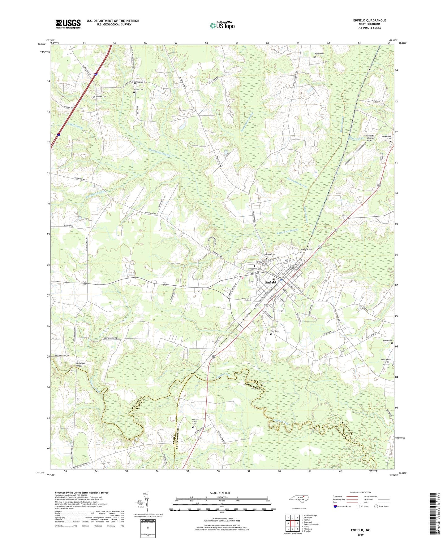
2019 topographic map quadrangle Enfield in the state of North Carolina. Scale: 1:24000. Based on the newly updated USGS 7.5' US Topo map series, this map is in the following counties: Halifax, Edgecombe, Nash. The map contains contour data, water features, and other items you are used to seeing on USGS maps, but also has updated roads and other features. This is the next generation of topographic maps. Printed on high-quality waterproof paper with UV fade-resistant inks.
Quads adjacent to this one:
West: Ringwood
Northwest: Aurelian Springs
North: Darlington
Northeast: Halifax
East: Dawson Crossroads
Southeast: Draughn
South: Whitakers
Southwest: Drake
Contains the following named places: Beaverdam Swamp, Bellamys Bridge, Breeches Swamp, Bricks, Bryant Cemetery, Burnt Coat Swamp, Coefield Cemetery, Dog Pond Branch, Eden Church, Elmwood Cemetery, Enfield, Enfield Church, Enfield Fire Department Station 3, Enfield Middle School, Enfield Police Department, Enfield Post Office, Enfield-Shearin Airport, Fishing Creek Millpond, Fishing Creek Millpond Dam, Halifax Emergency Medical Services Station 2 - Enfield Rescue Squad, Hardee Cemetery, Inborden School, Jacket Swamp, Marsh Swamp, Old Bricks Cemetery, Overstreet Cemetery, Pettitt Cemetery, Pittman Cemetery, Pope Cemetery, Smiths Chapel, Town of Enfield, Township of Enfield, Wards Crossroads, Willey Cemetery, ZIP Code: 27823