MyTopo
Darlington North Carolina US Topo Map
Couldn't load pickup availability
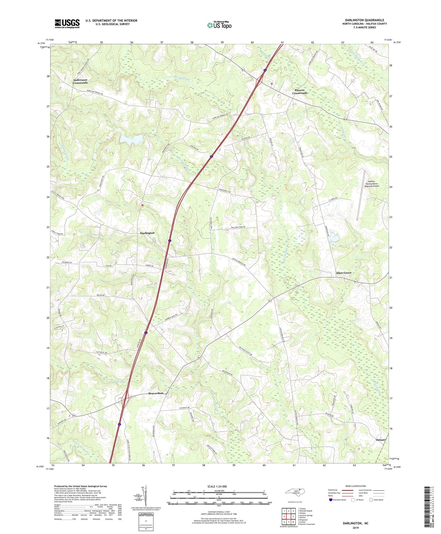
2022 topographic map quadrangle Darlington in the state of North Carolina. Scale: 1:24000. Based on the newly updated USGS 7.5' US Topo map series, this map is in the following counties: Halifax. The map contains contour data, water features, and other items you are used to seeing on USGS maps, but also has updated roads and other features. This is the next generation of topographic maps. Printed on high-quality waterproof paper with UV fade-resistant inks.
Quads adjacent to this one:
West: Aurelian Springs
Northwest: Thelma
North: Roanoke Rapids
Northeast: Weldon
East: Halifax
Southeast: Dawson Crossroads
South: Enfield
Southwest: Ringwood
This map covers the same area as the classic USGS quad with code o36077c6.
Contains the following named places: Allen Grove, Allen Grove Church, Andersons Crossroads, Beaverdam, Daniels Chapel, Darlington, Darlington Church, Darlington Fire Department, Delmar, Ebenezer Church, Halifax County, Halifax County Emergency Medical Services Station 8, Halifax Fire and Rescue Station 2, Halifax-Northampton Regional Airport, Lebanon Church, Martin Swamp, Mill Swamp, Pierces Campground Church, Pierces Crossroads, Pittman School, Pleasant Hill Church, Smith Chapel, Township of Faucett