MyTopo
Halifax North Carolina US Topo Map
Couldn't load pickup availability
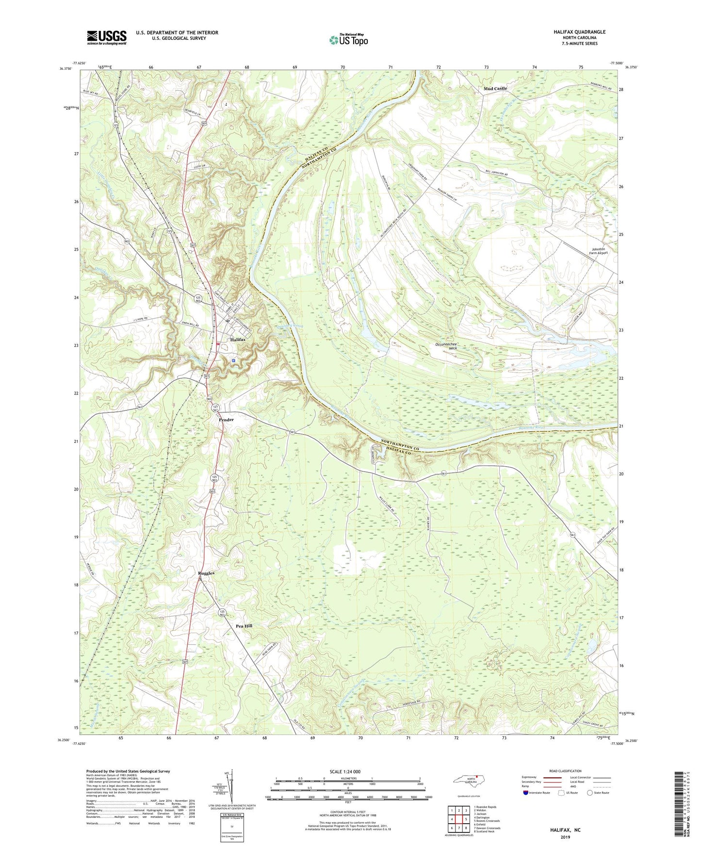
2022 topographic map quadrangle Halifax in the state of North Carolina. Scale: 1:24000. Based on the newly updated USGS 7.5' US Topo map series, this map is in the following counties: Halifax, Northampton. The map contains contour data, water features, and other items you are used to seeing on USGS maps, but also has updated roads and other features. This is the next generation of topographic maps. Printed on high-quality waterproof paper with UV fade-resistant inks.
Quads adjacent to this one:
West: Darlington
Northwest: Roanoke Rapids
North: Weldon
Northeast: Jackson
East: Boones Crossroads
Southeast: Scotland Neck
South: Dawson Crossroads
Southwest: Enfield
This map covers the same area as the classic USGS quad with code o36077c5.
Contains the following named places: Halifax, Halifax County Investigation, Halifax County Sheriff's Office, Halifax Fire Department Rescue Station 1, Halifax Post Office, Jackson School, Johnson Pond Dam Number Four, Johnson Pond Dam Number One, Johnson Pond Dam Number Three, Johnson Pond Dam Number Two, Johnson Pond Number Four, Johnson Pond Number Three, Johnston Farm Airport, Johnstons Pond, Johnstons Pond-B, Little Quankey Creek, Little Zion Church, Mud Castle, Occoneechee Neck, Pea Hill, Pender, Quankey Creek, Ruggles, Town of Halifax, Township of Halifax, Weldon Police Department, ZIP Code: 27839