MyTopo
Whitakers North Carolina US Topo Map
Couldn't load pickup availability
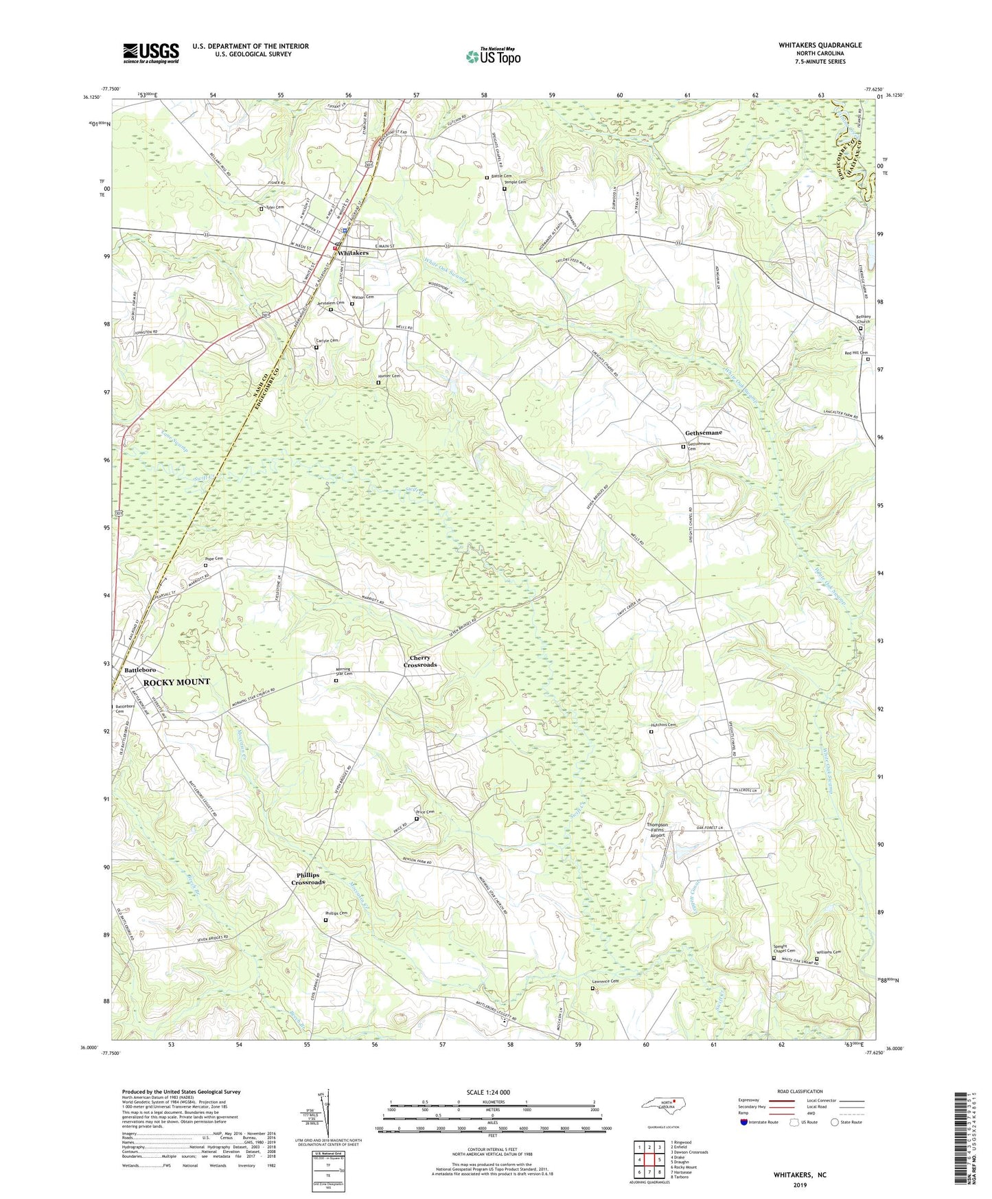
2022 topographic map quadrangle Whitakers in the state of North Carolina. Scale: 1:24000. Based on the newly updated USGS 7.5' US Topo map series, this map is in the following counties: Edgecombe, Nash, Halifax. The map contains contour data, water features, and other items you are used to seeing on USGS maps, but also has updated roads and other features. This is the next generation of topographic maps. Printed on high-quality waterproof paper with UV fade-resistant inks.
Quads adjacent to this one:
West: Drake
Northwest: Ringwood
North: Enfield
Northeast: Dawson Crossroads
East: Draughn
Southeast: Tarboro
South: Hartsease
Southwest: Rocky Mount
This map covers the same area as the classic USGS quad with code o36077a6.
Contains the following named places: Battle Cemetery, Battleboro, Bethany Church, Carlyle Cemetery, Cherry Crossroads, Gammons Pond, Gammons Pond Dam, Gethsemane, Gethsemane Cemetery, Hunter Cemetery, Hutchins Cemetery, Jerusalem Cemetery, Lane Swamp, Lawrence Cemetery, Moccasin Creek, Morning Star Cemetery, Morning Star Church, Phillips Cemetery, Phillips Crossroads, Phillips School, Pope Cemetery, Price Cemetery, Red Hill, Red Hill Cemetery, Red Hill Church, Saint Marks Church, Speight Chapel, Speight Chapel Cemetery, Taylor Crossroads, Temple Cemetery, Thompson Farms Airport, Town of Whitakers, Township 6-Upper Fishing Creek, Tyler Cemetery, Watson Cemetery, Whitakers, Whitakers Police Department, Whitakers Post Office, Whitakers School, Whitakers Volunteer Fire Department, Williams Cemetery, Williams Church, Willow Grove School, ZIP Codes: 27809, 27891