MyTopo
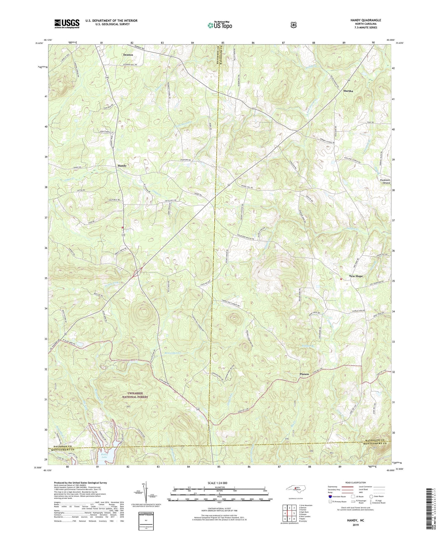
Handy North Carolina US Topo Map
Couldn't load pickup availability
Also explore the Handy Forest Service Topo of this same quad for updated USFS data
2022 topographic map quadrangle Handy in the state of North Carolina. Scale: 1:24000. Based on the newly updated USGS 7.5' US Topo map series, this map is in the following counties: Davidson, Randolph, Montgomery. The map contains contour data, water features, and other items you are used to seeing on USGS maps, but also has updated roads and other features. This is the next generation of topographic maps. Printed on high-quality waterproof paper with UV fade-resistant inks.
Quads adjacent to this one:
West: High Rock
Northwest: Grist Mountain
North: Denton
Northeast: Farmer
East: Eleazer
Southeast: Lovejoy
South: Badin
Southwest: New London
This map covers the same area as the classic USGS quad with code o35080e1.
Contains the following named places: Alls Fork, Beaverdam Creek, Big Creek, Calvary Gospel Church, Chapel Hill Church, Complex, Denton Airport, Grassy Fork, Gravel Hill Church, Handy, Liberty Church, Lineberry Church, Martha, Nanny Branch, New Hope, New Hope Church, New Hope Volunteer Fire Department Station 17, Piedmont Upland, Pine Hill Church, Pinson, Russels Mine, Salem Church, Siloam Church, South Davidson Fire Department Station 58, South Fork Second Creek, Spring Branch, Township of New Hope, Twomile Branch, Wallace Branch, Wind Hill, ZIP Code: 27239