MyTopo
Fair Grove North Carolina US Topo Map
Couldn't load pickup availability
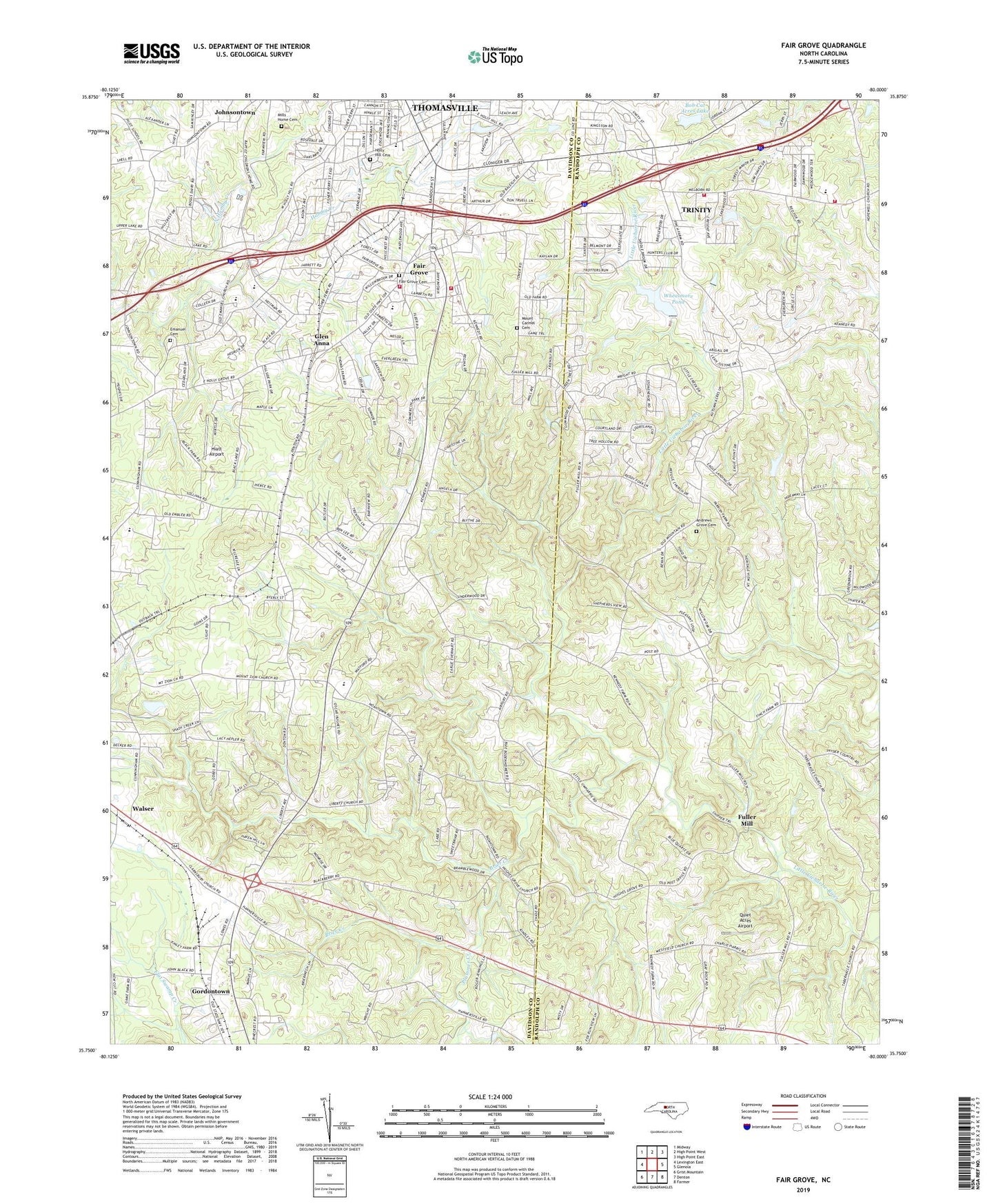
2022 topographic map quadrangle Fair Grove in the state of North Carolina. Scale: 1:24000. Based on the newly updated USGS 7.5' US Topo map series, this map is in the following counties: Davidson, Randolph. The map contains contour data, water features, and other items you are used to seeing on USGS maps, but also has updated roads and other features. This is the next generation of topographic maps. Printed on high-quality waterproof paper with UV fade-resistant inks.
Quads adjacent to this one:
West: Lexington East
Northwest: Midway
North: High Point West
Northeast: High Point East
East: Glenola
Southeast: Farmer
South: Denton
Southwest: Grist Mountain
This map covers the same area as the classic USGS quad with code o35080g1.
Contains the following named places: Andrews Grove Cemetery, Andrews Grove Church, Bethany Baptist Church, Bob Cat Acres Lake, Bob Cat Acres Lake Dam, Brier Creek, Cedar Lodge Baptist Church, Childers Airport, Clarksbury Church, E Lawson Brown Junior High School, East Davidson High School, Eden, Emanuel Cemetery, Emanuel United Church of Christ, Fair Grove, Fair Grove Cemetery, Fair Grove Fire Department HQ Station 43, Fair Grove Fire Department Substation 45, Fair Grove Methodist Church, Fair Grove School, Fairgrove Airport, Faith Chapel Church, Fuller Mill, Fullerdale, Glen Anna, Gordontown, Guil - Rand Fire Department Station 39, Hannersville Station, Hiatt Airport, Hillside Park Baptist Church, Holly Hill Memorial Park Cemetery, Hughes Grove Baptist Church, Johnsontown, Johnsontown Methodist Church, Kennedy Road Free Will Baptist Church, Liberty Baptist Church, Light, Loflins Store, Mendenhall Dam, Mendenhall Lake, Mills Home Cemetery, Mount Carmel Cemetery, Mount Zion Church, Mount Zion Wesleyan Church, North Hamby Creek, Pleasant Hill Church, Plummer Creek, Quiet Acres Airport, Thomas Lake, Thomas Lake Dam, Thomasville Fire Department Station 2, Walser, Westfield Church, Wheatmore Farm Lake Dam, Wheatmore Pond, ZIP Code: 27360