MyTopo
Freeman North Carolina US Topo Map
Couldn't load pickup availability
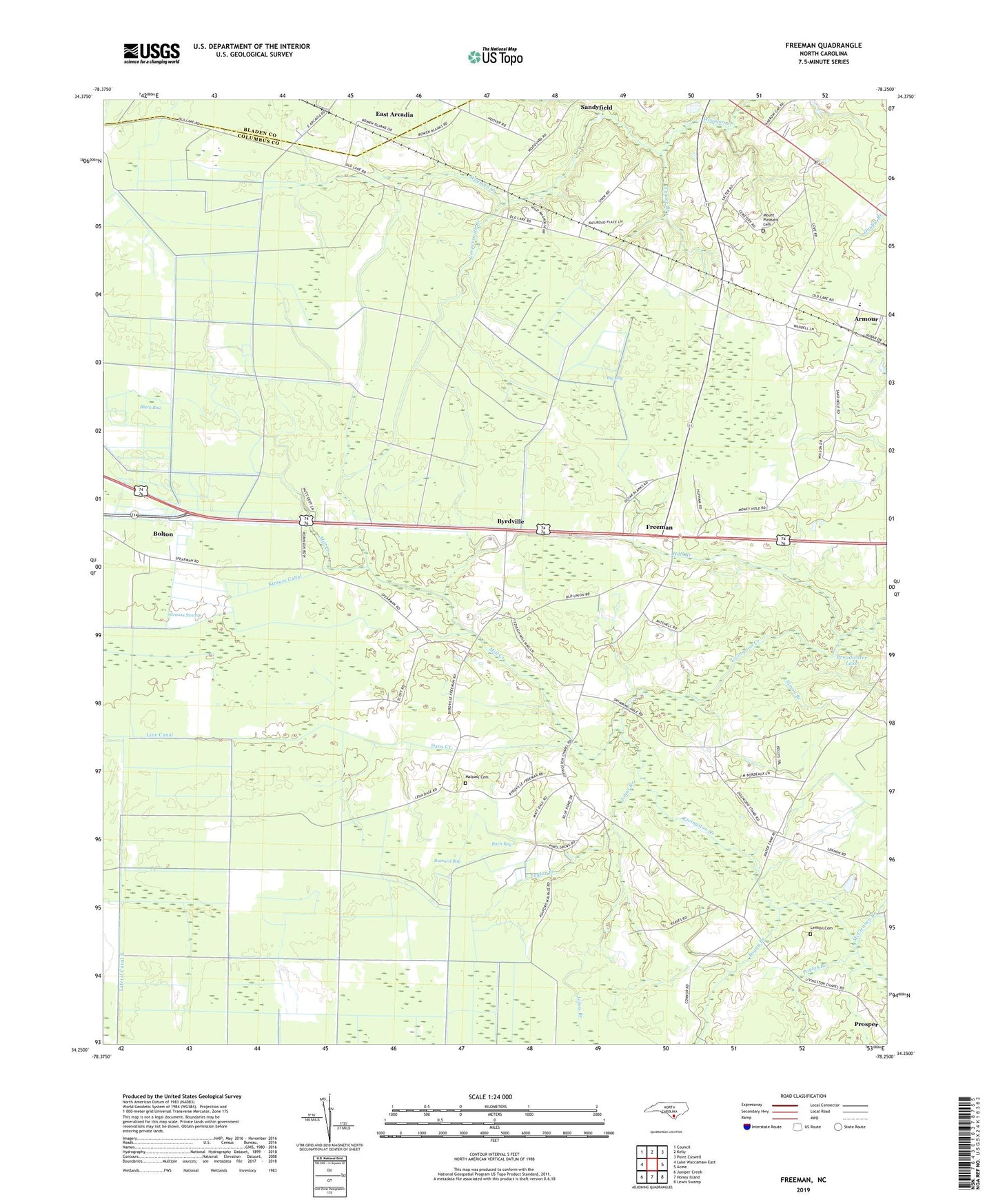
2019 topographic map quadrangle Freeman in the state of North Carolina. Scale: 1:24000. Based on the newly updated USGS 7.5' US Topo map series, this map is in the following counties: Columbus, Bladen. The map contains contour data, water features, and other items you are used to seeing on USGS maps, but also has updated roads and other features. This is the next generation of topographic maps. Printed on high-quality waterproof paper with UV fade-resistant inks.
Quads adjacent to this one:
West: Lake Waccamaw East
Northwest: Council
North: Kelly
Northeast: Point Caswell
East: Acme
Southeast: Lewis Swamp
South: Honey Island
Southwest: Juniper Creek
Contains the following named places: Abraham Church, Acme Delco Elementary School, Armour, Big Bay, Bitch Bay, Black Bay, Boggy Branch, Broadwater Lake, Buzzard Bay, Byrdville, Cheerful Hope Church, Coopersmith Branch, Dans Creek, Freeman, Hall Branch, Johns Branch, Lateral Canal E, Lateral Canal F, Lateral Canal G, Lennon Cemetery, Livingston Church, Malpass Cemetery, McClennen Branch, Mill Creek, Mount Pleasant Cemetery, Mount Pleasant Church, Piney Grove Church, Poplar Branch, Prosper, Red Hill Church, Scott Branch, Simon Branch, Strauss Canal, Strauss Swamp, Taylor Branch, Terrapin Branch, Town of Sandyfield, Township of Ransom, Turkeypen Branch, Turner Branch, Union Grove Church, ZIP Codes: 28436, 28456