MyTopo
Lewis Swamp North Carolina US Topo Map
Couldn't load pickup availability
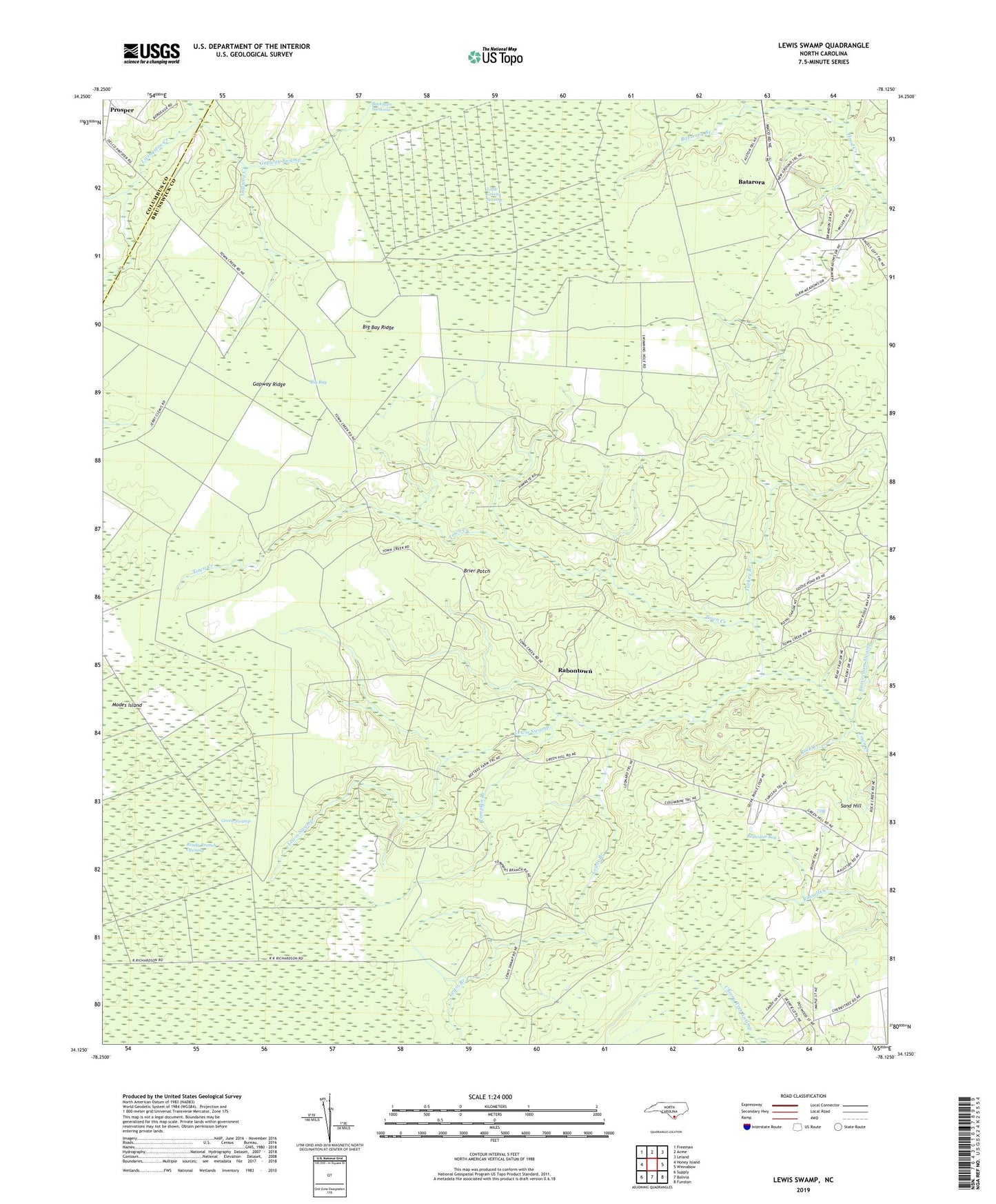
2022 topographic map quadrangle Lewis Swamp in the state of North Carolina. Scale: 1:24000. Based on the newly updated USGS 7.5' US Topo map series, this map is in the following counties: Brunswick, Columbus. The map contains contour data, water features, and other items you are used to seeing on USGS maps, but also has updated roads and other features. This is the next generation of topographic maps. Printed on high-quality waterproof paper with UV fade-resistant inks.
Quads adjacent to this one:
West: Honey Island
Northwest: Freeman
North: Acme
Northeast: Leland
East: Winnabow
Southeast: Funston
South: Bolivia
Southwest: Supply
This map covers the same area as the classic USGS quad with code o34078b2.
Contains the following named places: Batarora, Batarora Branch, Beaverdam Swamp, Big Bay, Big Bay Ridge, Brier Patch, Christian Hope Church, Community Chapel, Flowers Corner, Gapway Creek, Gapway Ridge, Gapway Swamp, Lewis Branch, Lewis Swamp, Little Green Swamp, Modes Island, Old Cumbee Place, Piney Grove, Rabontown, Ready Branch Opening, Redwater Bay, Rock Creek, Sand Hill, Tompkin Branch, Turkey Branch, WWAY-TV (Wilmington)