MyTopo
Hackney North Carolina US Topo Map
Couldn't load pickup availability
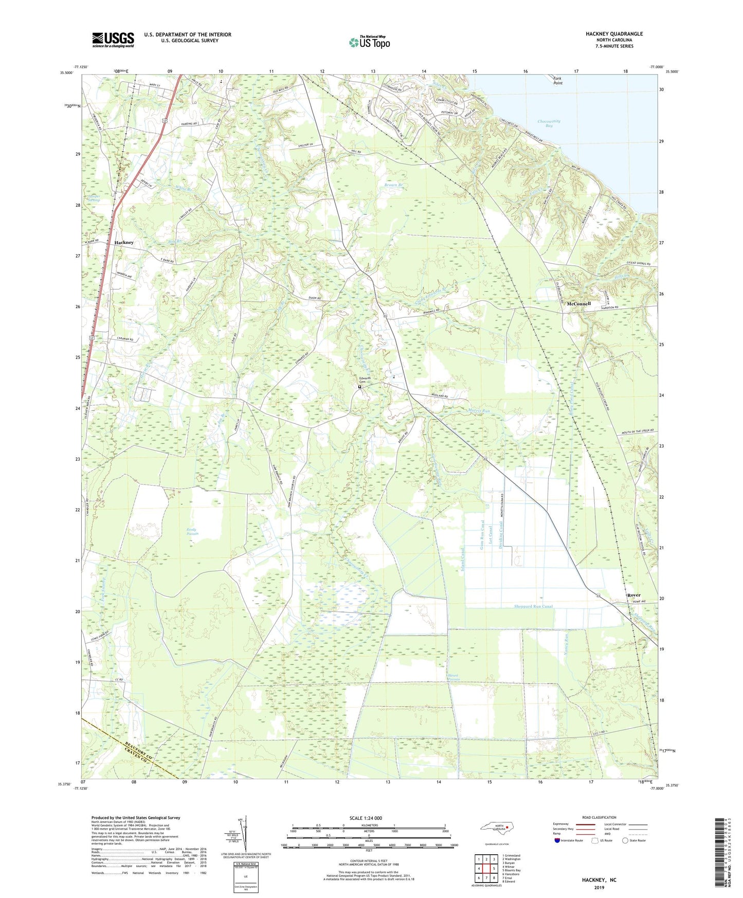
2019 topographic map quadrangle Hackney in the state of North Carolina. Scale: 1:24000. Based on the newly updated USGS 7.5' US Topo map series, this map is in the following counties: Beaufort, Craven. The map contains contour data, water features, and other items you are used to seeing on USGS maps, but also has updated roads and other features. This is the next generation of topographic maps. Printed on high-quality waterproof paper with UV fade-resistant inks.
Quads adjacent to this one:
West: Wilmar
Northwest: Grimesland
North: Washington
Northeast: Bunyan
East: Blounts Bay
Southeast: Edward
South: Ernul
Southwest: Vanceboro
Contains the following named places: Bay Branch, Blount Pocosin, Brown Branch, Cals Creek, Cedar Grove Church, Cindy Edwards Branch, Clay Bottom Church, Claybottom School, Cypress Landing Census Designated Place, Dividing Canal, Edwards Cemetery, Fork Point, Fork Point Island, Gum Run Canal, Gum Swamp Run, Hackney, Haw Branch Church, Hills Creek, Hog Hole Branch, Horse Branch, Island Canal, James Chapel, Joe Branch, Juniper Swamp, Lot Canal, Maple Grove School, McConnell, Morris Run, Noe Chapel, Piney Pond Canal, Providence Church, Reedy Pocosin, Rice Creek, Rover, Rover Station, Saint James Church, Sheppard Run Canal, Silas Creek, Township of Chocowinity, Union Chapel, White Branch, ZIP Code: 27817