MyTopo
Edward North Carolina US Topo Map
Couldn't load pickup availability
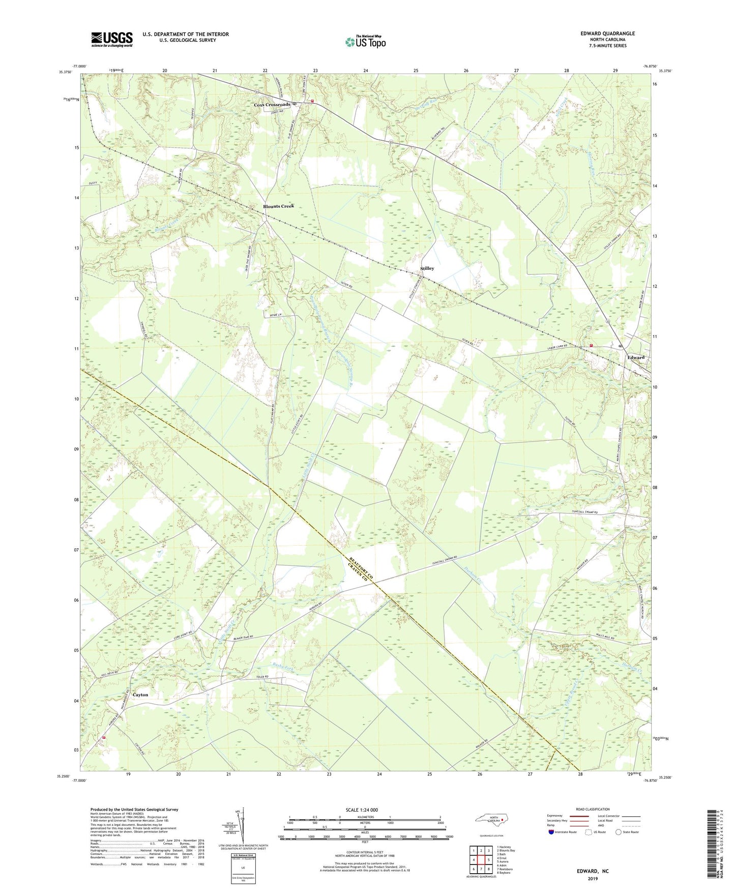
2022 topographic map quadrangle Edward in the state of North Carolina. Scale: 1:24000. Based on the newly updated USGS 7.5' US Topo map series, this map is in the following counties: Beaufort, Craven, Pamlico. The map contains contour data, water features, and other items you are used to seeing on USGS maps, but also has updated roads and other features. This is the next generation of topographic maps. Printed on high-quality waterproof paper with UV fade-resistant inks.
Quads adjacent to this one:
West: Ernul
Northwest: Hackney
North: Blounts Bay
Northeast: Bath
East: Aurora
Southeast: Bayboro
South: Reelsboro
Southwest: Askin
This map covers the same area as the classic USGS quad with code o35076c8.
Contains the following named places: Aurora Fire Department Edward Substation, Blounts Creek, Blounts Creek Post Office, Blounts Creek Volunteer Fire Department, Bushy Fork, Cayton, Coxs Crossroads, Edward, Edward Post Office, Egypt, Jones Store, Little Swift Creek Volunteer Fire Department, New Haven Church, Phennia Chapel, Poundpole Swamp Branch, Saint Anna Church, Saint Luke Church, Smyrna Church, Stilley, Triumph Church, Warren Chapel