MyTopo
Jerome North Carolina US Topo Map
Couldn't load pickup availability
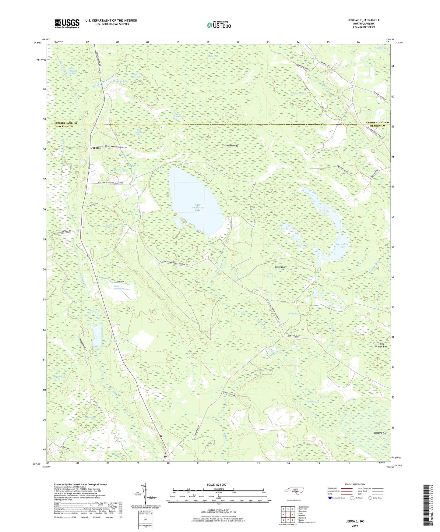
2019 topographic map quadrangle Jerome in the state of North Carolina. Scale: 1:24000. Based on the newly updated USGS 7.5' US Topo map series, this map is in the following counties: Bladen, Cumberland. The map contains contour data, water features, and other items you are used to seeing on USGS maps, but also has updated roads and other features. This is the next generation of topographic maps. Printed on high-quality waterproof paper with UV fade-resistant inks.
Quads adjacent to this one:
West: Duart
Northwest: Cedar Creek
North: Autryville
Northeast: Roseboro
East: Ammon
Southeast: Elizabethtown North
South: Dublin
Southwest: Tar Heel
Contains the following named places: Bennetts Bay, Big Gallberry Bay, Big Island, Broadwell Lake, Broadwell Lake Dam, Bucks Bay, Bushy Bay, Bushy Lake State Natural Area, C R Smith Dam, Cedar Swamp Bay, Center Church, China Grove Church, Cypress Pond, Dove Chapel, Flat Pond, Griffie Drain, Gum Swamp Bay, Horseshoe Lake, Horseshoe Lake Dam, Huckleberry Pond, Indian Creek, Jerome, Jessups Pond, Lake Run, Little Gallberry Bay, Little Singletary Lake, Live Oak Church, Marshy Bay, McCall Swamp, Rogers Bay, Round Pond, Sessoms Bay, Sharon Church, Suggs Grove Church, Thick Branch Bay, Township of White Oak, White Oak Fire Department, White Oak Post Office, White Pond Bay, Wolfs Bay, ZIP Code: 28399