MyTopo
Justice North Carolina US Topo Map
Couldn't load pickup availability
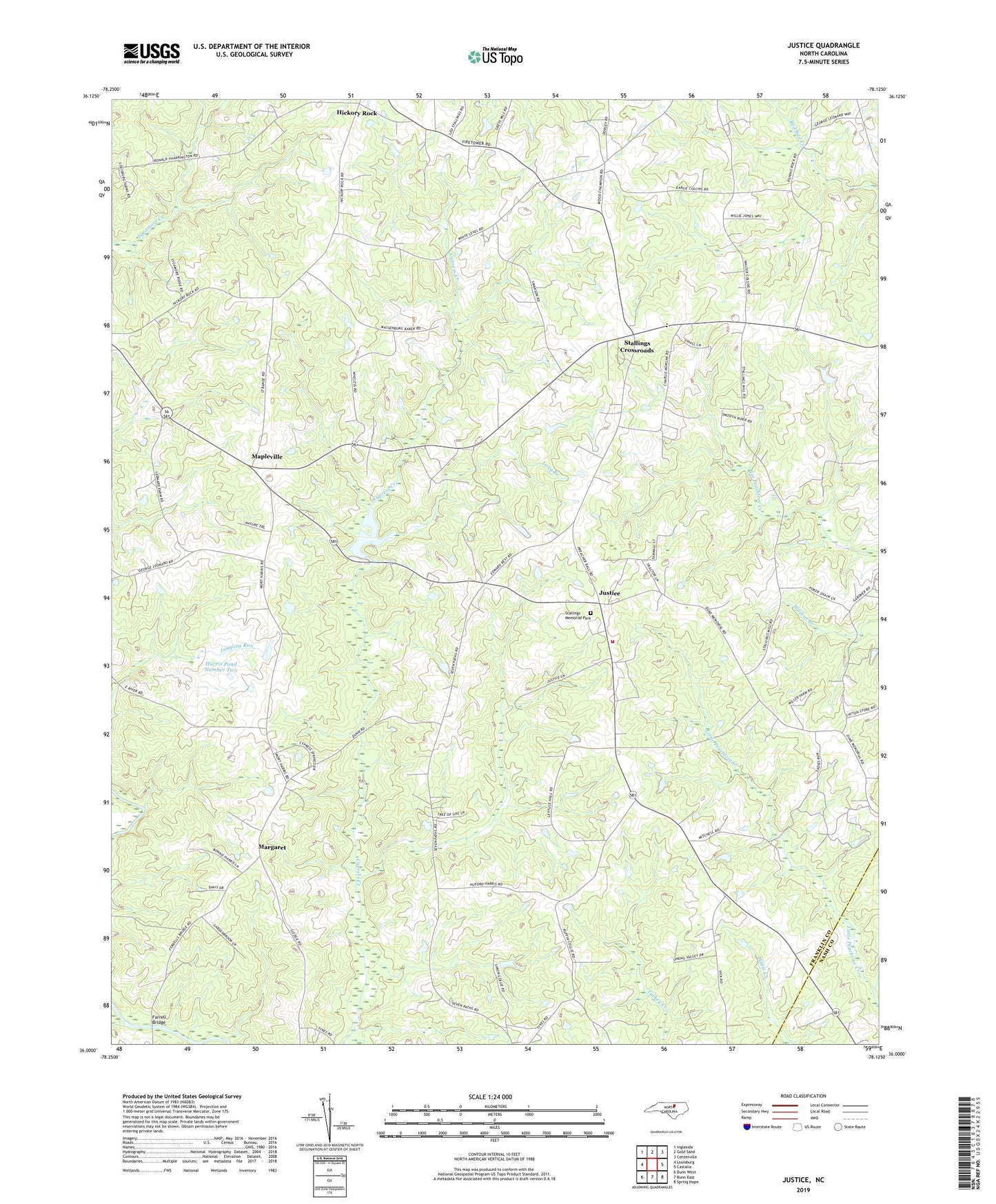
2019 topographic map quadrangle Justice in the state of North Carolina. Scale: 1:24000. Based on the newly updated USGS 7.5' US Topo map series, this map is in the following counties: Franklin, Nash. The map contains contour data, water features, and other items you are used to seeing on USGS maps, but also has updated roads and other features. This is the next generation of topographic maps. Printed on high-quality waterproof paper with UV fade-resistant inks.
Quads adjacent to this one:
West: Louisburg
Northwest: Ingleside
North: Gold Sand
Northeast: Centerville
East: Castalia
Southeast: Spring Hope
South: Bunn East
Southwest: Bunn West
Contains the following named places: Best High School, Cedar Rock Academy, Cedar Rock Church, Duke Memorial Church, Farrell Bridge, Gospel Church, Harris Pond Number Three, Harris Pond Number Three Dam, Harris Pond Number Two, Harris Pond Number Two Dam, Hickory Rock, Hickory Rock Church, Hickory Rock School, Jacksons Pond Dam, Justice, Justice Fire Department, Lettuce Hollow Church, Long Branch, Mapleville, Margaret, Saints Delight Church, Shiloh Church, Stallings Crossroads, Stallings Memorial Park, Township of Cedar Rock, Township of Cypress Creek, Walnut Grove Church, ZIP Code: 27549