MyTopo
Kenly East North Carolina US Topo Map
Couldn't load pickup availability
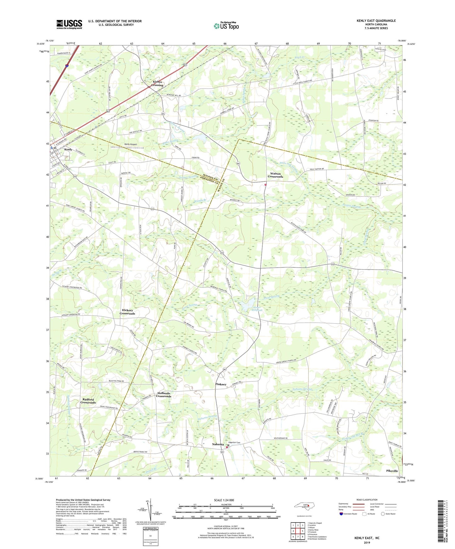
2019 topographic map quadrangle Kenly East in the state of North Carolina. Scale: 1:24000. Based on the newly updated USGS 7.5' US Topo map series, this map is in the following counties: Wayne, Wilson, Johnston. The map contains contour data, water features, and other items you are used to seeing on USGS maps, but also has updated roads and other features. This is the next generation of topographic maps. Printed on high-quality waterproof paper with UV fade-resistant inks.
Quads adjacent to this one:
West: Kenly West
Northwest: Stancils Chapel
North: Lucama
Northeast: Wilson
East: Fremont
Southeast: Northeast Goldsboro
South: Northwest Goldsboro
Southwest: Princeton
Contains the following named places: Aycock Millpond, Aycock Millpond Dam, Brandy Branch, Daniels Chapel, Edgerton Cemetery, Gospel Center, Hickory Crossroads, Hollands Crossroads, Johnston County Emergency Medical Services - Kenly, Juniper Swamp, Kenly, Kenly Airport, Kenly Police Department, Kenly Post Office, Kirbys Crossing, Macedonia Church, Memorial Church, Nahunta, Nahunta Elementary School, Nahunta Volunteer Fire Department, Nelson Swamp, Newson Millpond, Perkins Old Mill Branch, Piney Grove Church, Pinkney, Pinkney Missionary Baptist Church, Pitmans Grove Church, Polly Watson Volunteer Fire Department - Wayne County Station 28, Radford Crossroads, Red Maple Mobile Home Park, Robin Swamp, Sasser Millpond, Scotts Lake, Scotts Lake Dam, Tobacco Farm Life Museum, Township of Great Swamp, Union Grove Church, Upper Black Creek Church, Watson Crossroads, White Oak Church, White Oak Swamp