MyTopo
Princeton North Carolina US Topo Map
Couldn't load pickup availability
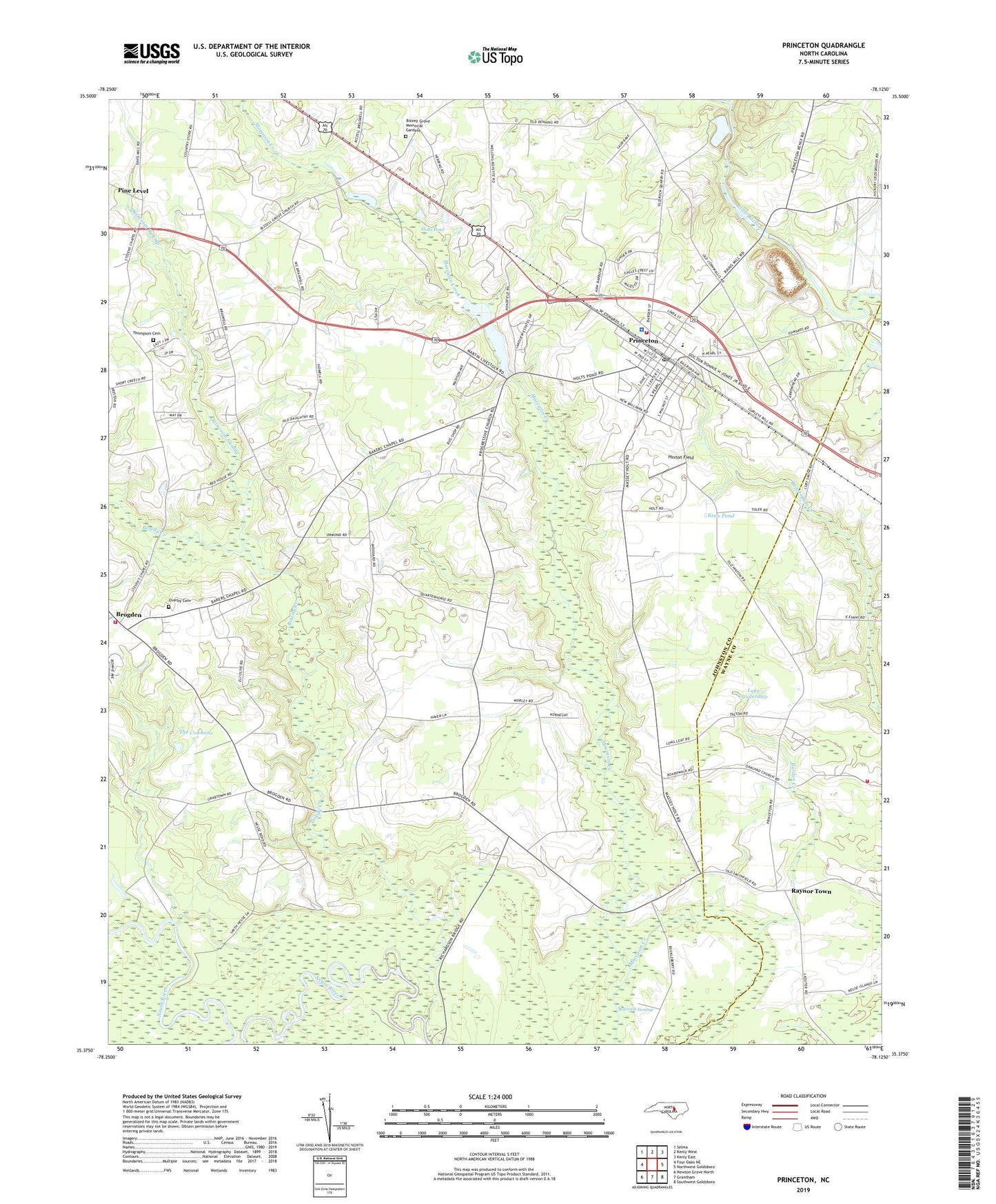
2022 topographic map quadrangle Princeton in the state of North Carolina. Scale: 1:24000. Based on the newly updated USGS 7.5' US Topo map series, this map is in the following counties: Johnston, Wayne. The map contains contour data, water features, and other items you are used to seeing on USGS maps, but also has updated roads and other features. This is the next generation of topographic maps. Printed on high-quality waterproof paper with UV fade-resistant inks.
Quads adjacent to this one:
West: Four Oaks NE
Northwest: Selma
North: Kenly West
Northeast: Kenly East
East: Northwest Goldsboro
Southeast: Southwest Goldsboro
South: Grantham
Southwest: Newton Grove North
This map covers the same area as the classic USGS quad with code o35078d2.
Contains the following named places: Bakers Chapel, Bawdy Creek, Bizzell Grove Church, Bizzell Grove Memorial Gardens, Brogden, Brogden Rural Fire Department, Burden Creek, Cedar Grove Church, Delwood, Grace Church, Hephzibah Church, Hinton Field, Holts Mill Pond Dam, Holts Pond, Keen Pond, Lake Lauderdale, Oakland Church, Old Union Church, Princeton, Princeton Police Department, Princeton Post Office, Princeton Quarry, Princeton Union School, Princeton Volunteer Fire Department, Quincosin Swamp, Raccoon Swamp, Raynor Town, Saint Pauls Church, Shiloh Church, Spring Branch, Stevens Chapel, The Cowbone, Thompson Cemetery, Town of Princeton, Township of Boon Hill, ZIP Code: 27569