MyTopo
Kimesville North Carolina US Topo Map
Couldn't load pickup availability
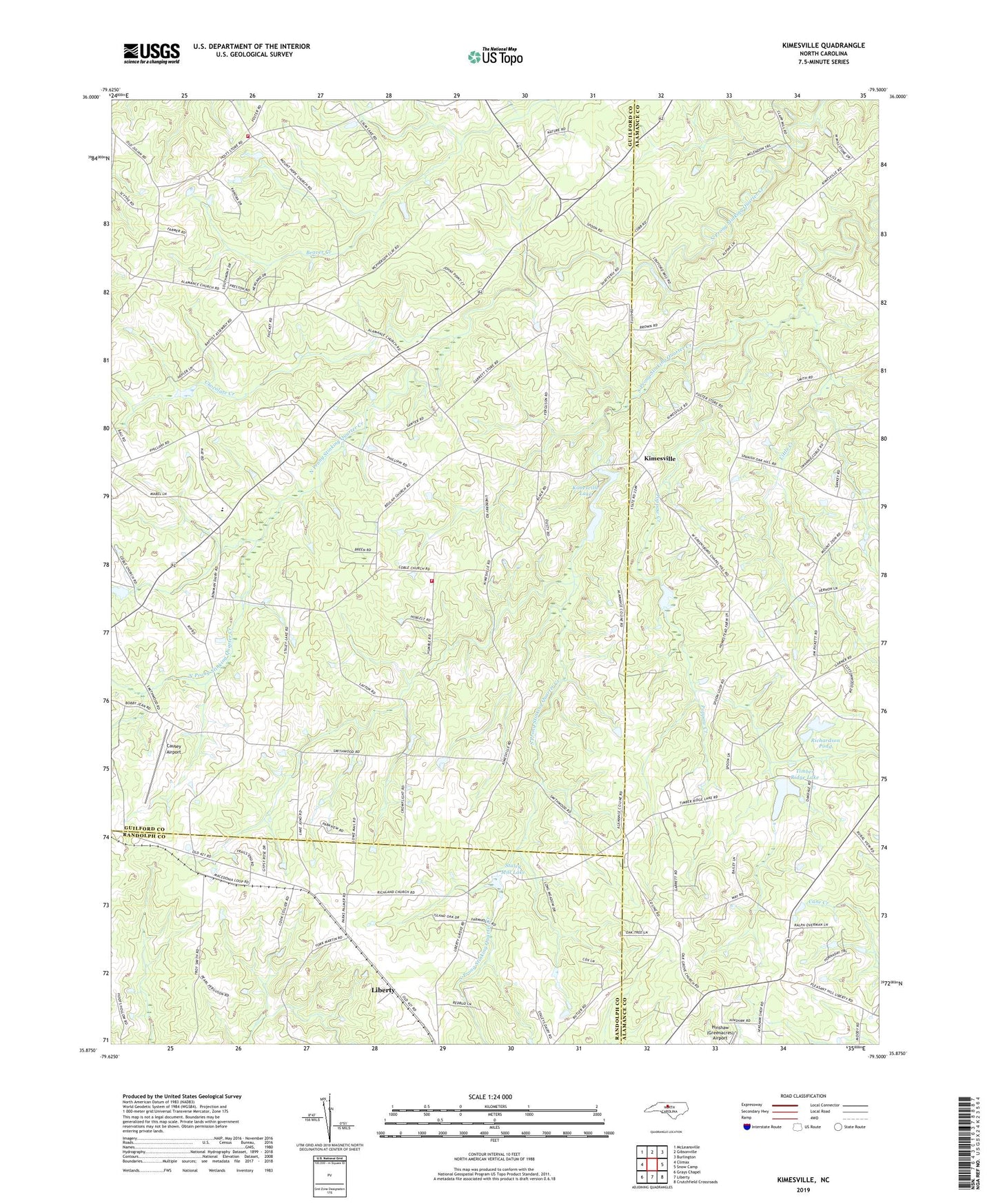
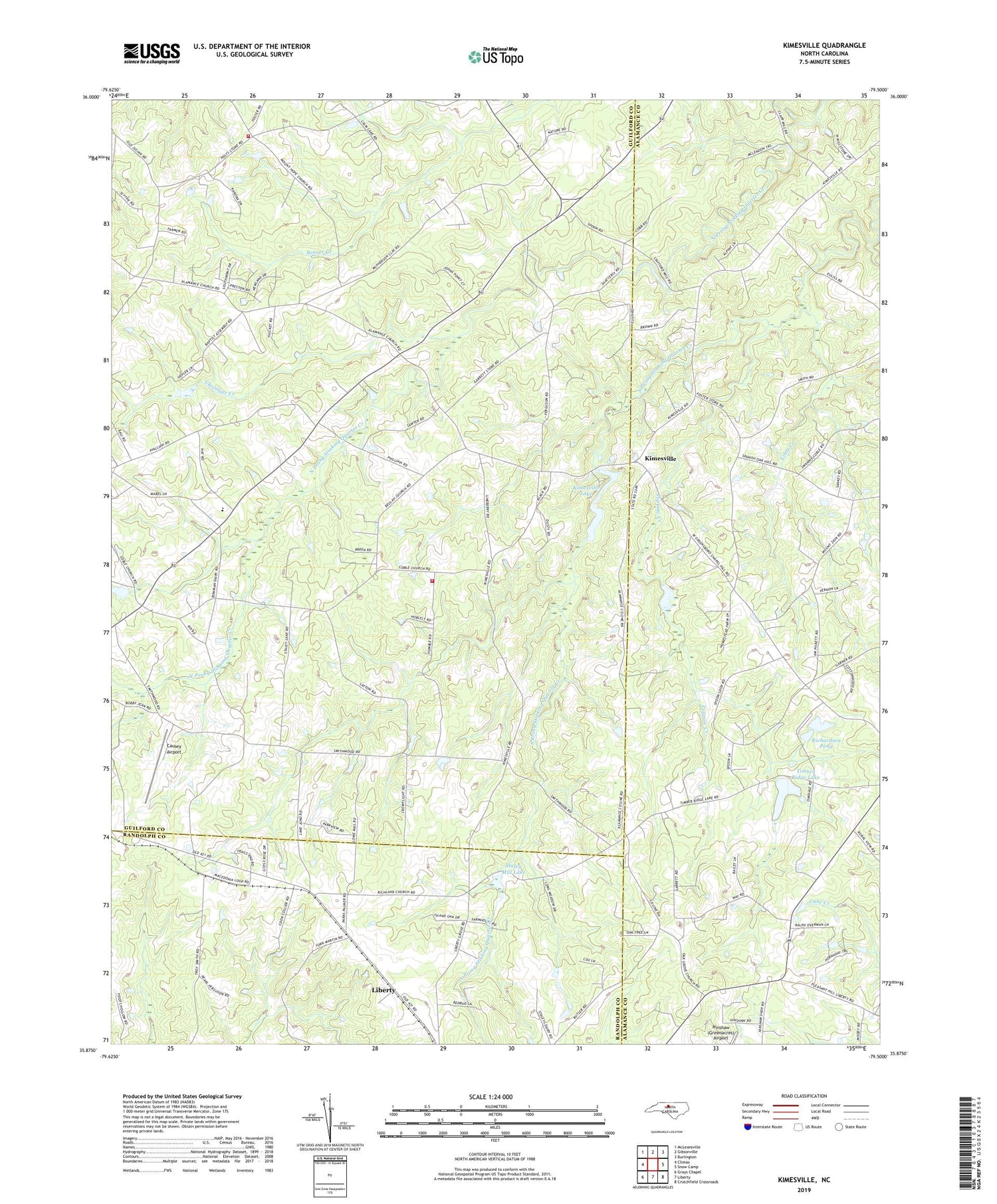
2019 topographic map quadrangle Kimesville in the state of North Carolina. Scale: 1:24000. Based on the newly updated USGS 7.5' US Topo map series, this map is in the following counties: Guilford, Alamance, Randolph. The map contains contour data, water features, and other items you are used to seeing on USGS maps, but also has updated roads and other features. This is the next generation of topographic maps. Printed on high-quality waterproof paper with UV fade-resistant inks.
Quads adjacent to this one:
West: Climax
Northwest: McLeansville
North: Gibsonville
Northeast: Burlington
East: Snow Camp
Southeast: Crutchfield Crossroads
South: Liberty
Southwest: Grays Chapel
Contains the following named places: Beulah Church, Causey Airport, Chocolate Creek, Evangelical Church, Hinshaw (Greenacres) Airport, Hornady Pleasant Union Church, Kimesville, Kimesville Lake, Kimesville Lake Dam, Kimesville Volunteer Fire Department, Little Creek, Lows Church, Macedonia Church, Mount Hope Community Fire Department, Mount Pleasant Church, Mount Zion Church, Nathanael Greene Elementary School, Oak Grove Church, Pleasant Union Church, Poppaw Creek, Richardson Pond, Richardson Pond Dam, Smithwood Church, Staley Mill Dam, Staley Mill Lake, Timber Ridge Lake, Timber Ridge Lake Dam, Township of Greene, ZIP Code: 27298