MyTopo
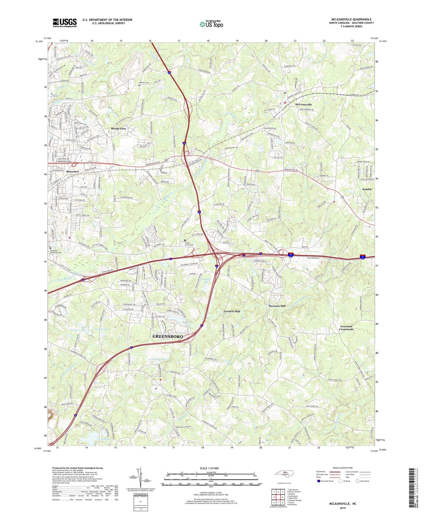
McLeansville North Carolina US Topo Map
Couldn't load pickup availability
2022 topographic map quadrangle McLeansville in the state of North Carolina. Scale: 1:24000. Based on the newly updated USGS 7.5' US Topo map series, this map is in the following counties: Guilford. The map contains contour data, water features, and other items you are used to seeing on USGS maps, but also has updated roads and other features. This is the next generation of topographic maps. Printed on high-quality waterproof paper with UV fade-resistant inks.
Quads adjacent to this one:
West: Greensboro
Northwest: Lake Brandt
North: Browns Summit
Northeast: Ossipee
East: Gibsonville
Southeast: Kimesville
South: Climax
Southwest: Pleasant Garden
This map covers the same area as the classic USGS quad with code o36079a6.
Contains the following named places: Alamance Church, Alamance School, Aydelette Lake, Aydelette Lake Dam, Beaver Creek, Bessemer, Bessemer Elementary School, Bessemer Shopping Center, Bethel Church, Buchanan Church, Carolina Hospital, Causey Lake, Causey Lake Dam, Center Church, Englewood Forest, Erwin Open Elementary School, Forbis Lake, Forbis Lake Dam, Franklin Boulevard Chapel, Fryar Lake, Fryar Lake Dam, Greensboro Fire Department Station 56, Greesons Crossroads, Guilford County Fire Station 54, Hackett Lake, Higgins Lake, Higgins Lake Dam, Jorden Branch, Joseph Allred Dam, Laughlin Memorial Church, Lynnwood Lake, Lynwood Lake Dam, McConnell Road Church, McLeansville, McLeansville Census Designated Place, McLeansville Church, McLeansville Fire Department Station 37, McLeansville Fire Department Station 47, McLeansville Middle School, McLeansville Post Office, Midway Cemetery, Midway Church, Mount Pleasant Church, Mount Zion, Muddy Creek, North Buffalo Chapel, Piedmont Memorial Cemetery, Saint James Church, Sedalia Elementary School, Shady Grove Cemetery, Stewarts Mill, Township of Gilmer, Township of Jefferson, Troxlers Mill, Twin Oaks Church, Woodard Memorial Church, Youth Focus Psychiatric Hospital, ZIP Codes: 27301, 27405


