MyTopo
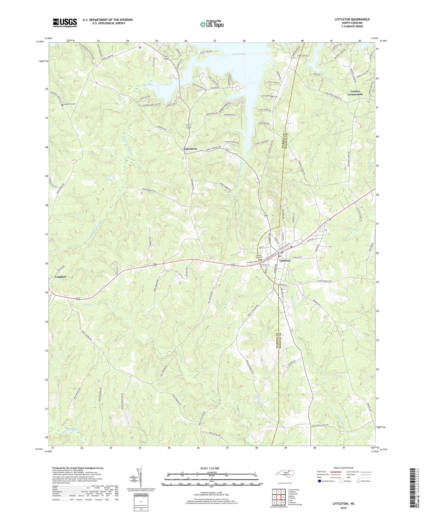
Littleton North Carolina US Topo Map
Couldn't load pickup availability
2022 topographic map quadrangle Littleton in the state of North Carolina. Scale: 1:24000. Based on the newly updated USGS 7.5' US Topo map series, this map is in the following counties: Warren, Halifax. The map contains contour data, water features, and other items you are used to seeing on USGS maps, but also has updated roads and other features. This is the next generation of topographic maps. Printed on high-quality waterproof paper with UV fade-resistant inks.
Quads adjacent to this one:
West: Macon
Northwest: South Hill SE
North: Gasburg
Northeast: Valentines
East: Thelma
Southeast: Aurelian Springs
South: Hollister
Southwest: Inez
This map covers the same area as the classic USGS quad with code o36077d8.
Contains the following named places: Ashley Grove Church, Bethlehem Church, Big Stone House Creek, Camp Willow Run, Cooleys Crossroads, Enterprise, Enterprise Church, Gruvers Memorial Church, Little Stone House Creek, Littleton, Littleton Police Department, Littleton Post Office, Littleton Volunteer Fire Department, Longbridge Volunteer Fire Department, Macons Grave, Mciver School, Mill Creek, Olive Grove Church, Panacea Springs, Pleasant Zion Church, Roanoke Chapel, Saint Annas Church, Sunset Hill Cemetery, Town of Littleton, Township of Judkins, Township of River, Vaughan Elementary School, Warren County Rescue Squad, Weaver Chapel, ZIP Code: 27850