MyTopo
Thelma North Carolina US Topo Map
Couldn't load pickup availability
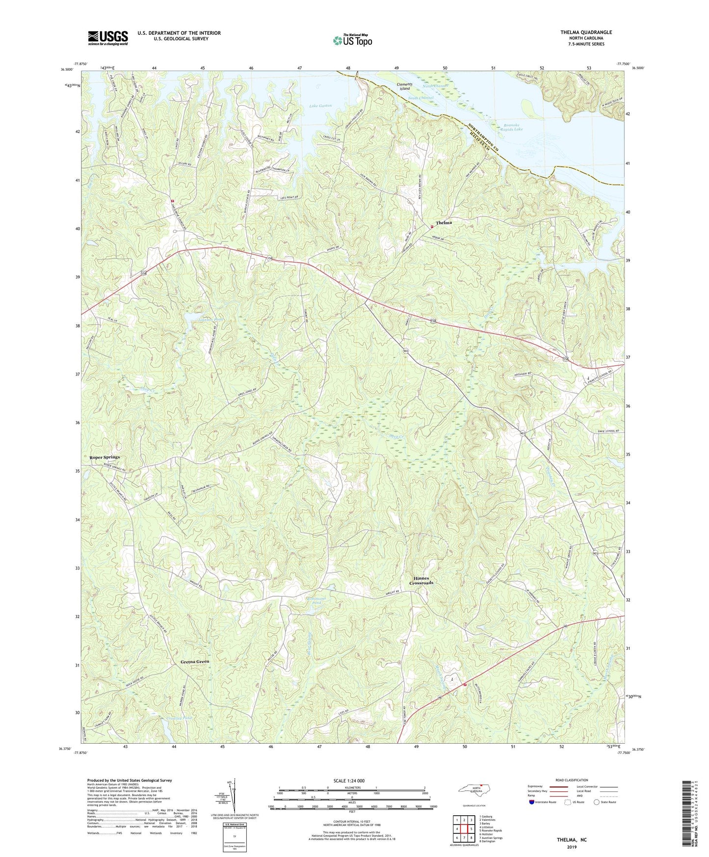
2022 topographic map quadrangle Thelma in the state of North Carolina. Scale: 1:24000. Based on the newly updated USGS 7.5' US Topo map series, this map is in the following counties: Halifax, Northampton. The map contains contour data, water features, and other items you are used to seeing on USGS maps, but also has updated roads and other features. This is the next generation of topographic maps. Printed on high-quality waterproof paper with UV fade-resistant inks.
Quads adjacent to this one:
West: Littleton
Northwest: Gasburg
North: Valentines
Northeast: Barley
East: Roanoke Rapids
Southeast: Darlington
South: Aurelian Springs
Southwest: Hollister
This map covers the same area as the classic USGS quad with code o36077d7.
Contains the following named places: Babbitts Chapel, Cagles Pond, Cagles Pond Dam, Calvary Church, Clements Island, Corinth Church, Cornerstone Church, Crawley Pond, Davie Volunteer Fire Department Station 2, Deep Creek, Dickens Pond Dam, Everetts School, Fidelity Church, Gretna Green, Hawkins Chapel, Hinnes Crossroads, Johnson Pond, Liles Lookout Tower, Littleton Volunteer Fire Department, Mount Gilliam Church, Mount Olive Church, North Channel, Northwest High School, Oak Grove Church, Poe Creek, Rheasville Volunteer Fire Department Substation, Robinsons Pond, Robinsons Pond Dam, Roper Springs, South Channel, Summit, Thelma, Township of Littleton, Walnut Grove Church, Warrens Pond