MyTopo
Broad Creek North Carolina US Topo Map
Couldn't load pickup availability
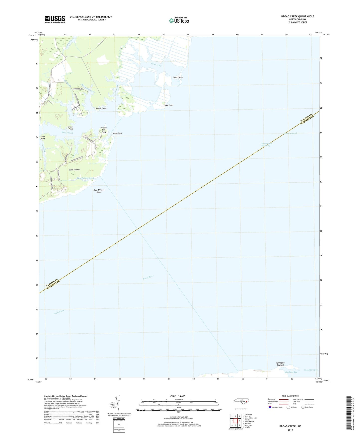
2022 topographic map quadrangle Broad Creek in the state of North Carolina. Scale: 1:24000. Based on the newly updated USGS 7.5' US Topo map series, this map is in the following counties: Carteret, Pamlico. The map contains contour data, water features, and other items you are used to seeing on USGS maps, but also has updated roads and other features. This is the next generation of topographic maps. Printed on high-quality waterproof paper with UV fade-resistant inks.
Quads adjacent to this one:
West: Oriental
Northwest: Vandemere
North: Jones Bay
Northeast: Little Fishing Point
East: Point of Marsh
Southeast: Long Bay
South: South River
Southwest: Merrimon
This map covers the same area as the classic USGS quad with code o35076a5.
Contains the following named places: Broad Creek, Burton Creek, Cedar Creek, Cedar Point, Dowdy Point, Florence School, Grace Point, Green Creek, Gum Thicket, Gum Thicket Creek, Gum Thicket Shoal, Mill Creek, Parris Creek, Pasture Creek, Piney Point, Piney Point Creek, Pittman Creek, Skate Point, Swan Creek, Swan Island, Tar Creek, Tonney Hill Point, Turnagain Bay Spit, Wading Creek, Zion Hill Church