MyTopo
Point of Marsh North Carolina US Topo Map
Couldn't load pickup availability
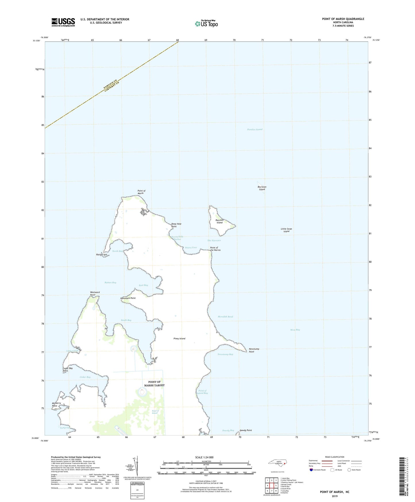
2022 topographic map quadrangle Point of Marsh in the state of North Carolina. Scale: 1:24000. Based on the newly updated USGS 7.5' US Topo map series, this map is in the following counties: Carteret, Pamlico. The map contains contour data, water features, and other items you are used to seeing on USGS maps, but also has updated roads and other features. This is the next generation of topographic maps. Printed on high-quality waterproof paper with UV fade-resistant inks.
Quads adjacent to this one:
West: Broad Creek
Northwest: Jones Bay
North: Little Fishing Point
East: North Bay
Southeast: Atlantic
South: Long Bay
Southwest: South River
This map covers the same area as the classic USGS quad with code o35076a4.
Contains the following named places: Big Swan Island, Cedar Bay, Cedar Bay Point, Cedar Island Bay Light, Deep Hole, Deep Hole Point, Dowdy Point, East Bay, Hammock Point, Henry Hills Harbor, Little Creek, Little Swan Island, Meredith Bend, Mulberry Point, Mulberry Point Creek, Newstump Bay, Newstump Point, North Bay, Peters Cove, Point of Island, Point of Island Bay, Point of Marsh, Point of Marsh Light, Point of the Narros, Raccoon Island, Rattan Bay, Rattan Spit, South Bay, The Narrows, Tump Gut, West Bay, Westward Point