MyTopo
Chinquapin North Carolina US Topo Map
Couldn't load pickup availability
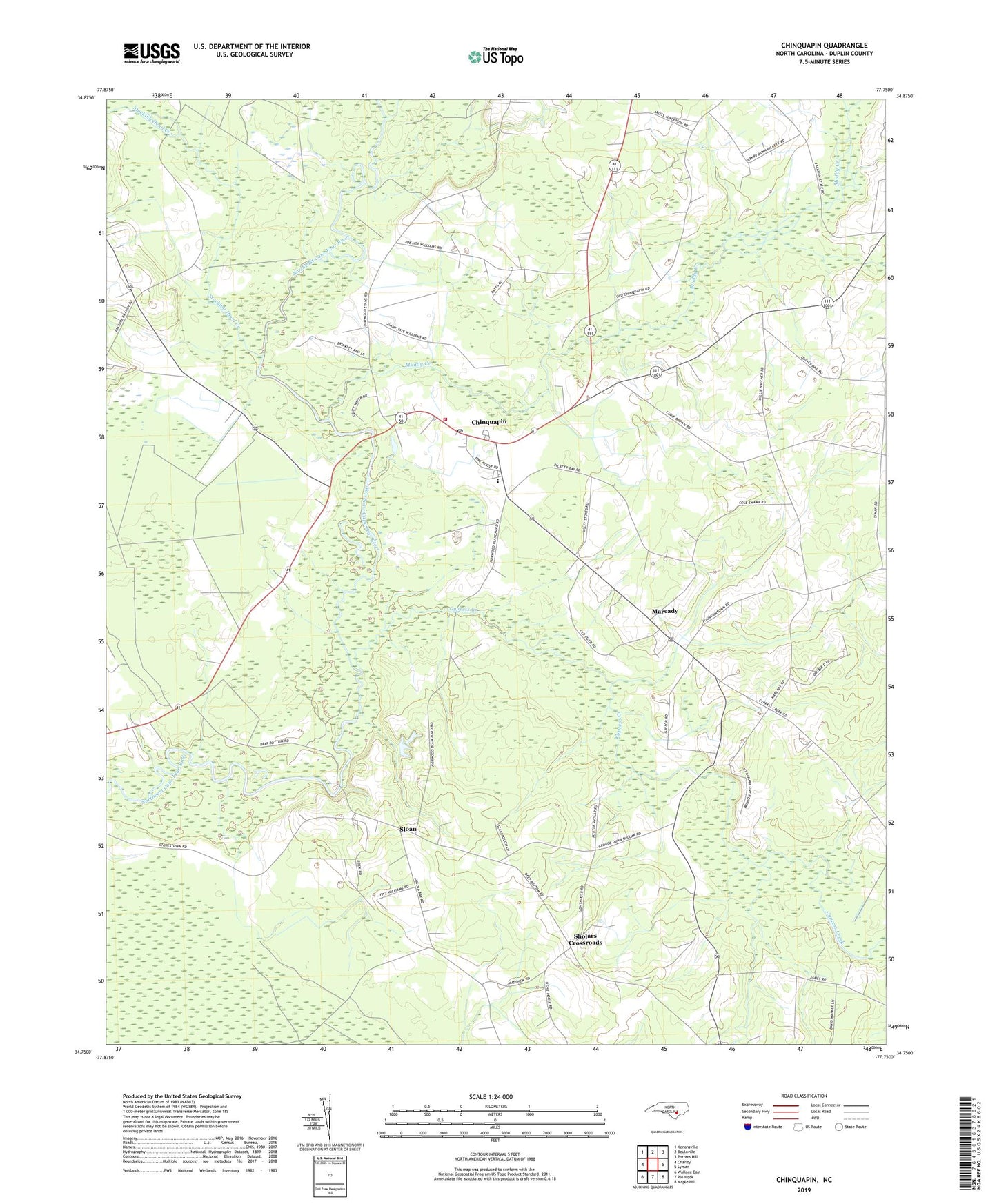
2022 topographic map quadrangle Chinquapin in the state of North Carolina. Scale: 1:24000. Based on the newly updated USGS 7.5' US Topo map series, this map is in the following counties: Duplin. The map contains contour data, water features, and other items you are used to seeing on USGS maps, but also has updated roads and other features. This is the next generation of topographic maps. Printed on high-quality waterproof paper with UV fade-resistant inks.
Quads adjacent to this one:
West: Charity
Northwest: Kenansville
North: Beulaville
Northeast: Potters Hill
East: Lyman
Southeast: Maple Hill
South: Pin Hook
Southwest: Wallace East
This map covers the same area as the classic USGS quad with code o34077g7.
Contains the following named places: Bethel Church, Chinquapin, Chinquapin Census Designated Place, Chinquapin Elementary School, Chinquapin II Elementary School, Chinquapin Lookout Tower, Chinquapin Post Office, Chinquapin Volunteer Fire and Rescue, Coles Chapel, Cypress Creek, Duplin County Emergency Medical Services Medic 3, First Baptist Church, Laniers Chapel, Maready, Mount Horeb Church, Muddy Creek, Oak Dale Church, Saint Louis Baptist Church, Sharon Church, Shiloh Baptist Church, Sholars Crossroads, Sloan, Stephens Swamp, Stocking Head Creek, Township of Cypress Creek