MyTopo
Price North Carolina US Topo Map
Couldn't load pickup availability
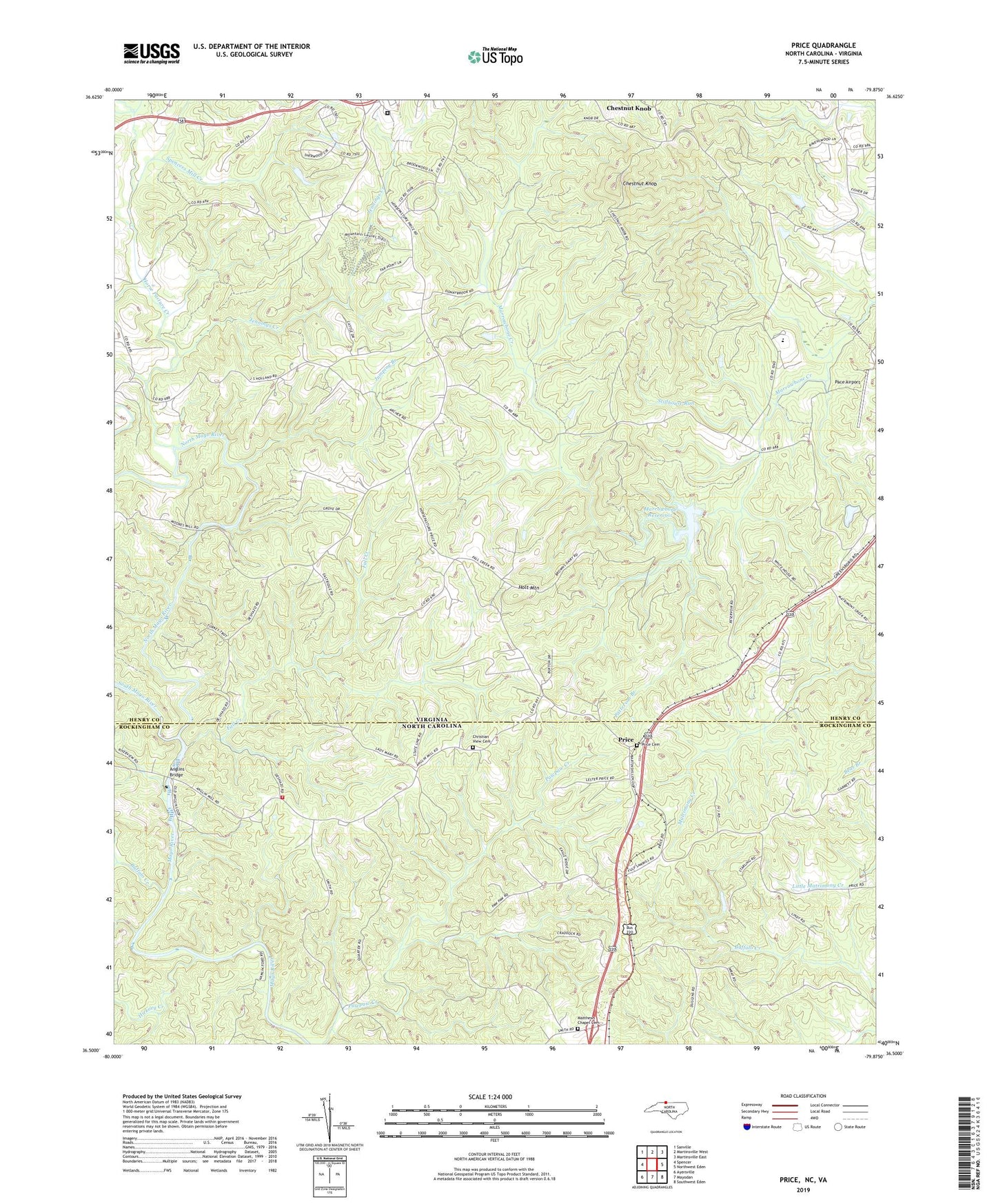
2022 topographic map quadrangle Price in the states of Virginia, North Carolina. Scale: 1:24000. Based on the newly updated USGS 7.5' US Topo map series, this map is in the following counties: Rockingham, Henry. The map contains contour data, water features, and other items you are used to seeing on USGS maps, but also has updated roads and other features. This is the next generation of topographic maps. Printed on high-quality waterproof paper with UV fade-resistant inks.
Quads adjacent to this one:
West: Spencer
Northwest: Sanville
North: Martinsville West
Northeast: Martinsville East
East: Northwest Eden
Southeast: Southwest Eden
South: Mayodan
Southwest: Ayersville
Contains the following named places: Anglins Bridge, Buffalo Creek, Chestnut Knob, Christian View Cemetery, Christian View Pentecostal Holiness Church, Clarke School, Dunnivan School, Fall Creek, Green Spring School, Hickory Creek, Holmes Memorial Church, Holt Mountain, Horse Pasture Church, Horse Pasture Creek, Horsepasture Volunteer Rescue Squad, Jennings Creek, Jumping Branch, Lakewood Forest, Lees Ford Camp, Magna Vista High School, Marrowbone Creek Number One Dam, Marrowbone Reservoir, Matthews Chapel Cemetery, Matthews Chapel United Methodist Church, Mayo Church, Mount Zion Church, Mount Zion School, Mountain School, Muddy Creek, New Jerusalem Church, North Mayo River, North Stoneyview Volunteer Fire Department, Pace Airport, Patrick Henry Correctional Unit 28, Patterson Branch, Price, Price United Methodist Church, Price United Methodist Church Cemetery, Rangeley School, Red Plain School, Ridgeway Sportsmen Club, Smith Memorial Church, South Mayo River, Spencers Mill Creek, Stillhouse Run, Township of Price, Watkins School, Whites Chapel, ZIP Code: 24148