MyTopo
Morven East North Carolina US Topo Map
Couldn't load pickup availability
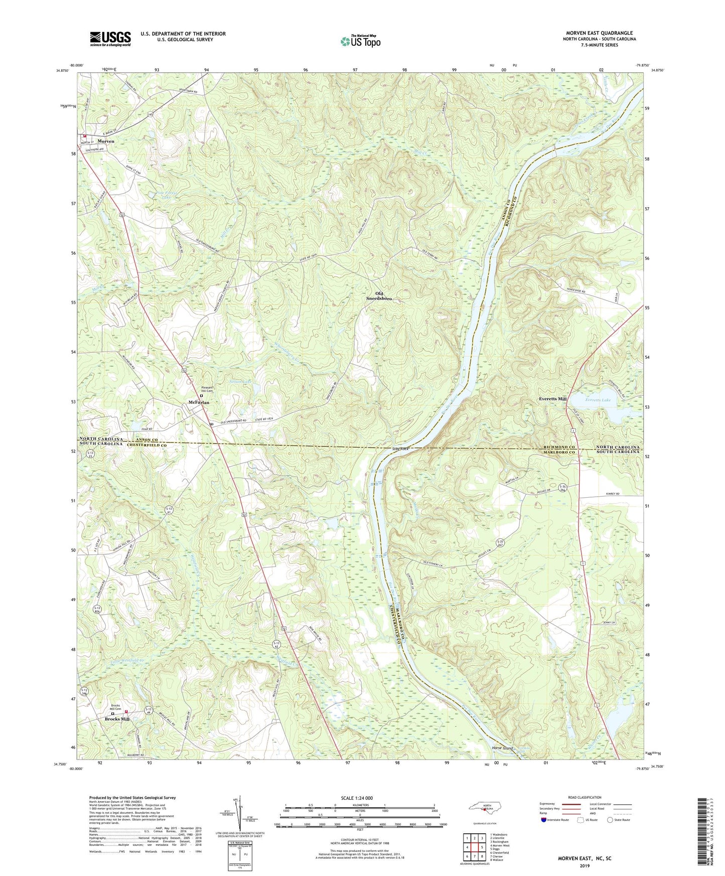
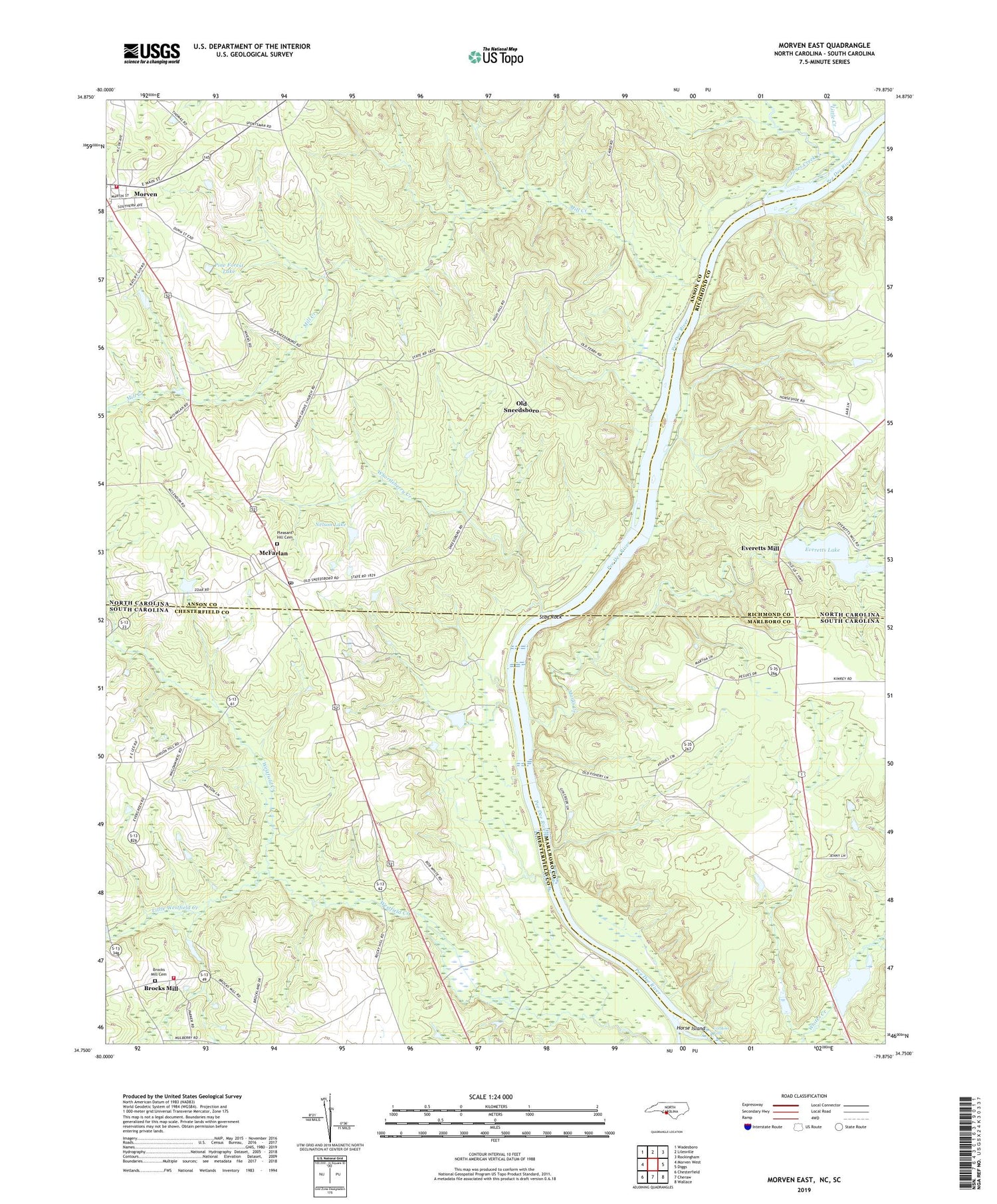
2019 topographic map quadrangle Morven East in the states of North Carolina, South Carolina. Scale: 1:24000. Based on the newly updated USGS 7.5' US Topo map series, this map is in the following counties: Anson, Chesterfield, Marlboro, Richmond. The map contains contour data, water features, and other items you are used to seeing on USGS maps, but also has updated roads and other features. This is the next generation of topographic maps. Printed on high-quality waterproof paper with UV fade-resistant inks.
Quads adjacent to this one:
West: Morven West
Northwest: Wadesboro
North: Lilesville
Northeast: Rockingham
East: Diggs
Southeast: Wallace
South: Cheraw
Southwest: Chesterfield
Contains the following named places: Bethel Church, Britts School, Brocks Mill, Brocks Mill Baptist Church, Brocks Mill Cemetery, Brocks Mill Fire Department Station 1, Everett Lake Dam, Everetts Lake, Everetts Mill, Galilee Church, Goodmans Creek, Gordons Falls, Horse Island, Jones Creek, Laneys, Little Creek, Little Westfield Creek, Marks Creek, McFarlan, McFarlan Post Office, Mill Creek, Morven Volunteer Fire Department, Mount Zion Church, Mount Zion Methodist Church Cemetery, Mount Zion School, Nelson Lake, Nelson Lake Dam, New Hope Church, New Hope School, Old Sneedsboro, Parkers Ferry, Paul Wallace Pond, Peagues Mill, Phillips Pond Dam D-3215, Pine Forest Lake, Pleasant Hill Cemetery, Pusser Pond, Pusser Pond Dam D-3425, Ramah Grove Church, South Carolina Noname 35015 Dam D-3427, Stag Rock, Town of McFarlan, Township of Morven, Whortleberry Creek, ZIP Code: 28102