MyTopo
Chesterfield South Carolina US Topo Map
Couldn't load pickup availability
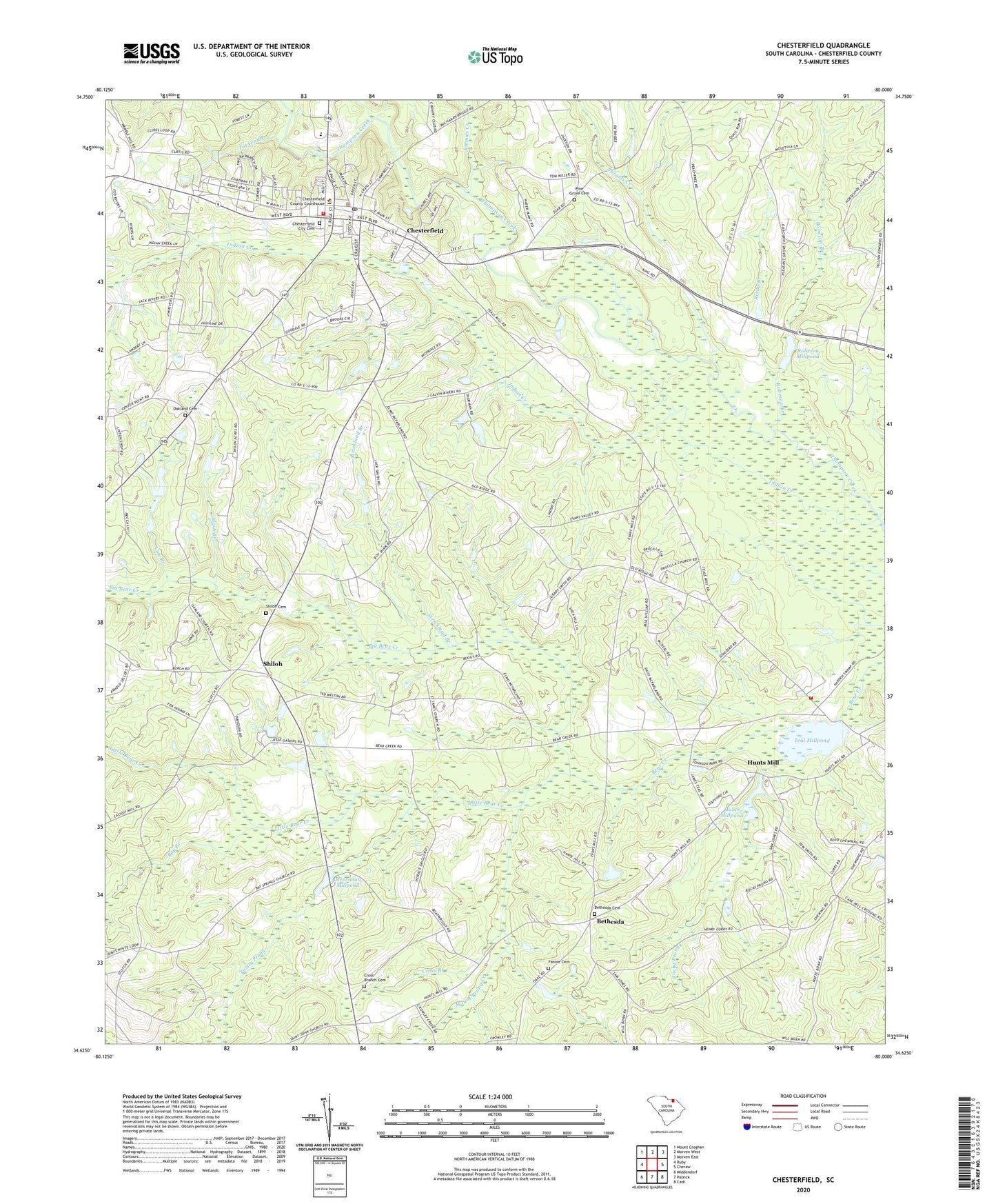
2024 topographic map quadrangle Chesterfield in the state of South Carolina. Scale: 1:24000. Based on the newly updated USGS 7.5' US Topo map series, this map is in the following counties: Chesterfield. The map contains contour data, water features, and other items you are used to seeing on USGS maps, but also has updated roads and other features. This is the next generation of topographic maps. Printed on high-quality waterproof paper with UV fade-resistant inks.
Quads adjacent to this one:
West: Ruby
North: Morven West
Northeast: Morven East
East: Cheraw
Southeast: Cash
South: Patrick
Southwest: Middendorf
This map covers the same area as the classic USGS quad with code o34080f1.
Contains the following named places: Abrams Creek, Bay Branch, Bay Branch Cemetery, Bay Branch Church, Bethel School, Bethesda, Bethesda Cemetery, Bethesda Church, Bethesda School, Big Bear Creek, Catoe, Chesterfield, Chesterfield City Cemetery, Chesterfield Community Cemetery, Chesterfield Division, Chesterfield Fire Department, Chesterfield High School, Chesterfield Middle School, Chesterfield Police Department, Chesterfield Rescue Squad, Cow Branch, Craigs Mill, Cross Branch, Cross Branch Cemetery, Cross Branch Church, Drucilla Church, Drucilla School, Edwards School, Evans Mill, Fannie Cemetery, Fords Mill, Hunts Mill, Hunts Millpond, Hunts Spring, Hurst Pond Dam D-3204, Indian Creek, Jimmies Creek, Little Bear Creek, Lower Macedonia Baptist Church, Mash Branch, Merriman Mill, Merriman Millpond, Mount Mary Baptist Church, Mount Mary Church Cemetery, Mount Olive School, Mount Prong Creek, Oakland Baptist Church, Oakland Cemetery, Odom Mill, Peniel Church, Peniel Church Cemetery, Pine Grove Baptist Church, Pine Grove Cemetery, Piney Grove School, Polson Mill, Pows Mill, Reedy Branch, Rivers, Rivers Chapel Baptist Church, Robeson Branch, Robeson Millpond, Robeson Millpond Dam D-3207, Rocky Prong, Saint James Church, Saint James Church Cemetery, Saint James School, Shiloh, Shiloh Cemetery, Shiloh Church, Shiloh School, South Carolina Noname 13001 D-3206 Dam, Sowells Pond Dam D-3205, Spence School, Spencer Mill Creek, Stewarts Mill, Strickland Branch, Tavern Branch, Teal Chapel Baptist Church, Teal Millpond, Teals Mill, Teals Mill Rural Volunteer Fire Department, Teals Millpond, Town of Chesterfield, Twitty Prong, ZIP Code: 29709