MyTopo
Pike Road North Carolina US Topo Map
Couldn't load pickup availability
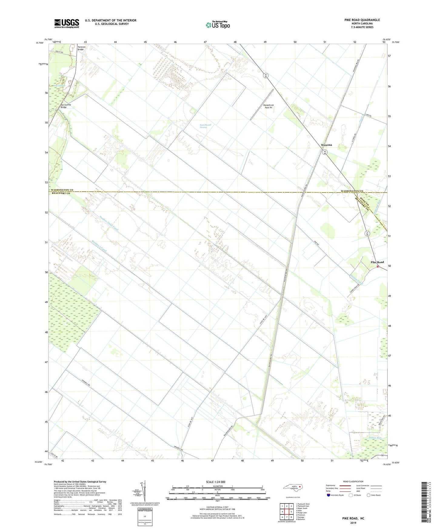
2019 topographic map quadrangle Pike Road in the state of North Carolina. Scale: 1:24000. Based on the newly updated USGS 7.5' US Topo map series, this map is in the following counties: Beaufort, Washington, Hyde. The map contains contour data, water features, and other items you are used to seeing on USGS maps, but also has updated roads and other features. This is the next generation of topographic maps. Printed on high-quality waterproof paper with UV fade-resistant inks.
Quads adjacent to this one:
West: Hoke
Northwest: Plymouth West
North: Plymouth East
Northeast: Roper South
East: Pungo Lake
Southeast: Belhaven
South: Pantego
Southwest: Pinetown
Contains the following named places: Donalds Air Park, Donald's Air Park Inc, East Dismal Swamp, Flat Swamp, Johnson Siding, Morning Star Church, Morrisons Store, Number 2 Canal, Number Three Canal, Oregon Canal, Pike Road, Pungo River Volunteer Fire Department, Sixteen Mile Siding, Sixth Landing, Sixth Siding, Tareover Bridge, Upper Pungo School, Van Swamp Bridge, Wenona, Wenona Church, ZIP Code: 27860