MyTopo
Pantego North Carolina US Topo Map
Couldn't load pickup availability
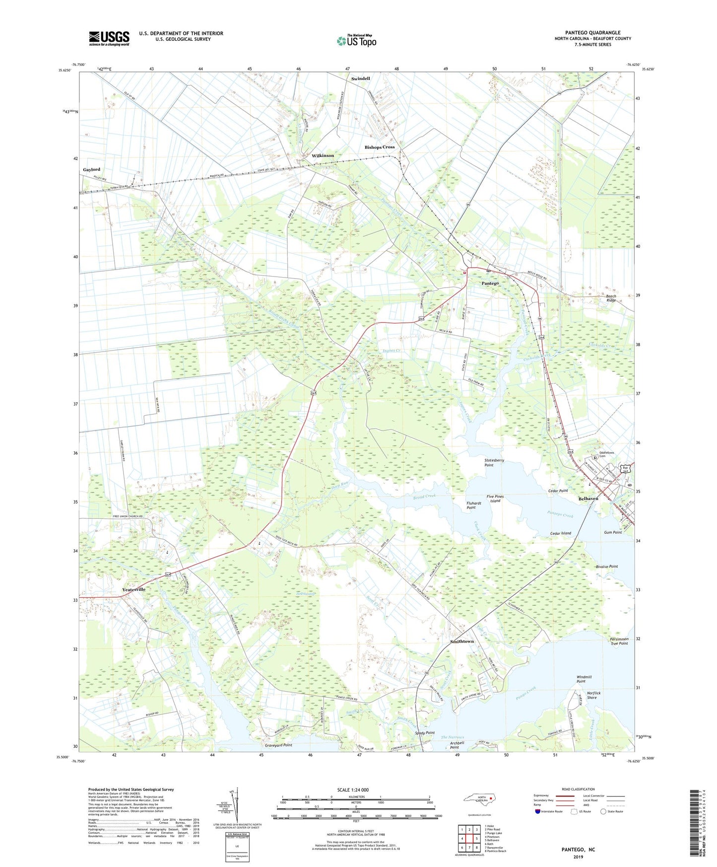
2022 topographic map quadrangle Pantego in the state of North Carolina. Scale: 1:24000. Based on the newly updated USGS 7.5' US Topo map series, this map is in the following counties: Beaufort. The map contains contour data, water features, and other items you are used to seeing on USGS maps, but also has updated roads and other features. This is the next generation of topographic maps. Printed on high-quality waterproof paper with UV fade-resistant inks.
Quads adjacent to this one:
West: Pinetown
Northwest: Hoke
North: Pike Road
Northeast: Pungo Lake
East: Belhaven
Southeast: Pamlico Beach
South: Ransomville
Southwest: Bath
This map covers the same area as the classic USGS quad with code o35076e6.
Contains the following named places: Archbell Point, Beaufort Elementary School, Belhaven Memorial Museum, Belhaven Post Office, Bellhaven Water Treatment Plant, Bishops Cross, Bivalve Point, Broad Creek, Broad Creek Canal, Broad Creek Church, Cedar Island, Cedar Point, Clark Creek, Cuckolds Creek, Deep Run, First Assembly of God Church, Five Pines Island, Fluhardt Point, Gaylord, Graveyard Point, Gum Point, Hell Swamp, Ingoes Creek, Little Creek, Norflick Shore, Odd Fellows Cemetery, Old Mill Creek, Pantego, Pantego Church, Pantego Junior High School, Pantego Post Office, Pantego Volunteer Fire Department, Pentego Post Office, Persimmon Tree Point, Pungo Fisheries, Pungo Swamp, Roper Ditch, Scott Creek, Shoemaker Creek, Smith Creek, Smithtown, Spady Point, Stotesberry Point, Swindell, The Narrows, Town of Pantego, Township of Pantego, Vale Creek, West Belhaven Church of Christ, Wilkinson, Windmill Point, Yeatesville