MyTopo
Pinetown North Carolina US Topo Map
Couldn't load pickup availability
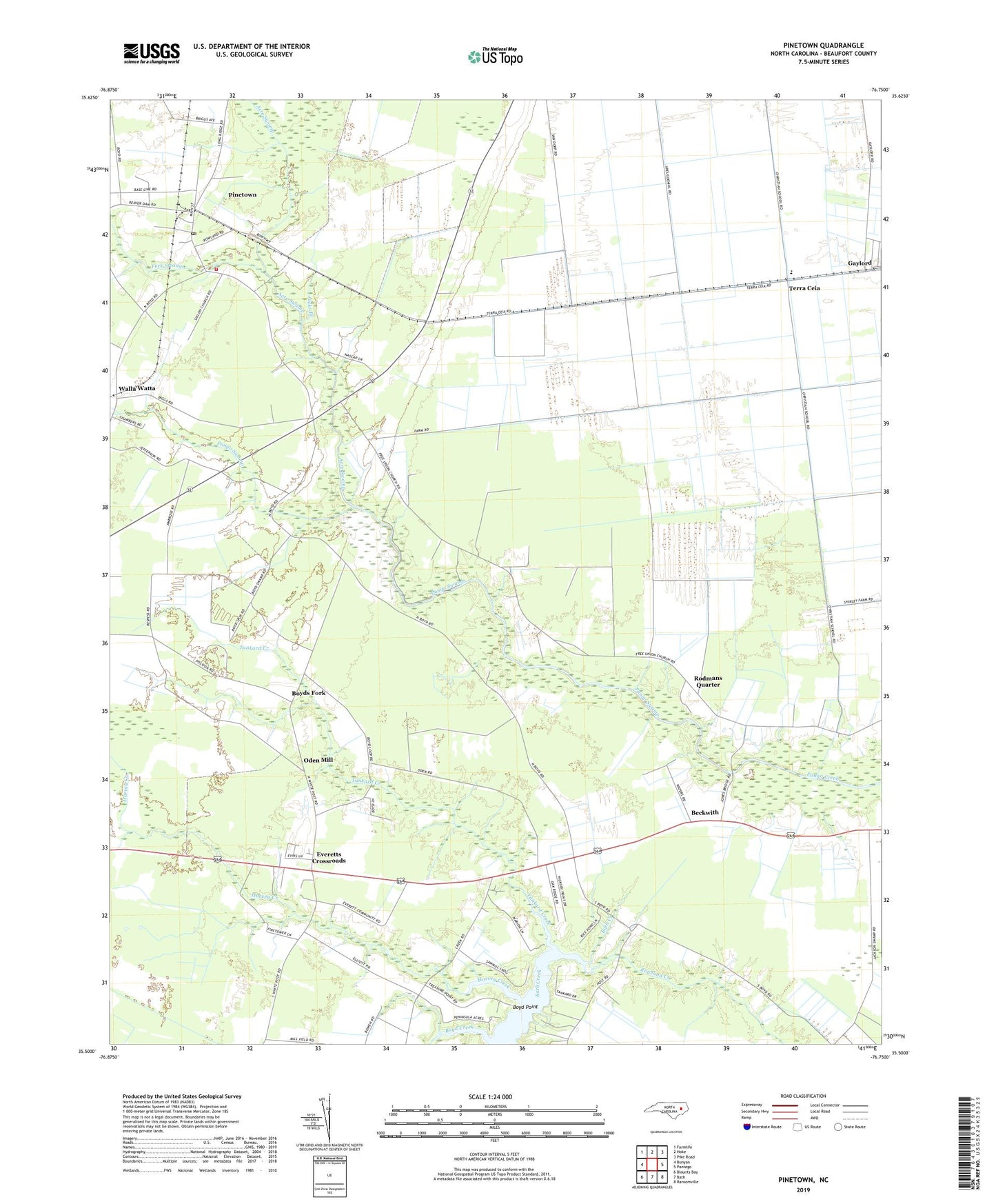
2022 topographic map quadrangle Pinetown in the state of North Carolina. Scale: 1:24000. Based on the newly updated USGS 7.5' US Topo map series, this map is in the following counties: Beaufort. The map contains contour data, water features, and other items you are used to seeing on USGS maps, but also has updated roads and other features. This is the next generation of topographic maps. Printed on high-quality waterproof paper with UV fade-resistant inks.
Quads adjacent to this one:
West: Bunyan
Northwest: Farmlife
North: Hoke
Northeast: Pike Road
East: Pantego
Southeast: Ransomville
South: Bath
Southwest: Blounts Bay
This map covers the same area as the classic USGS quad with code o35076e7.
Contains the following named places: Acre, Acre Bridge, Acre Church, Acre Swamp, Acresville Post Office, Beckwith, Boyd Creek, Boyd Point, Boyds Fork, Everett Church, Everett Lookout Tower, Everetts Crossroads, Fork Swamp, Free Union Church, Harvey Creek, Hunters Bridge, Jacks Branch, Keech Airport, Leeward Seine Beach, Oden Mill, Pampticough Precinct, Pinetown, Pinetown Census Designated Place, Pinetown Elementary School, Pinetown Post Office, Pinetown Rescue and Emergency Medical Services, Pinetown Volunteer Fire Department Station 1, Respess Field, Rodmans Quarter, Rodmans Quarter School, Rowland Creek, Shiloh Church, Tankard Creek, Terra Ceia, Walla Watta, White Plain Church