MyTopo
Ridgeville North Carolina US Topo Map
Couldn't load pickup availability
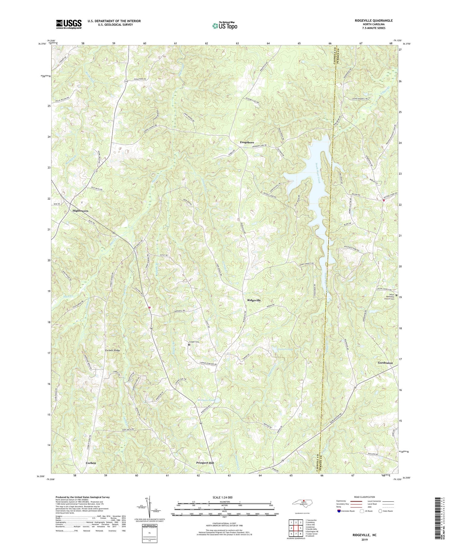
2019 topographic map quadrangle Ridgeville in the state of North Carolina. Scale: 1:24000. Based on the newly updated USGS 7.5' US Topo map series, this map is in the following counties: Caswell, Person. The map contains contour data, water features, and other items you are used to seeing on USGS maps, but also has updated roads and other features. This is the next generation of topographic maps. Printed on high-quality waterproof paper with UV fade-resistant inks.
Quads adjacent to this one:
West: Anderson
Northwest: Yanceyville
North: Leasburg
Northeast: Olive Hill
East: Hurdle Mills
Southeast: Caldwell
South: Cedar Grove
Southwest: Burlington NE
Contains the following named places: Allens Chapel, Bethel Church, Beulah Church, Carvers Lake, Carvers Lake Dam, Coneys Creek, Cooper Cemetery, Corbett Ridge, Frogsboro, Gordonton, Griers Church, Hebron Church, Hesters Grove Church, Hesters Store, Hightowers, Hurdle Mills Fire Department, Hyco Church, Lea Bethel Church, Lynch Creek, Morgans Pond, Negro Creek, Panther Branch, Prospect Hill Church, Prospect Hill Volunteer Fire Department, Ridgeville, Salem Methodist Church Cemetery, Salem United Methodist Church, Sugartree Creek, Township of Hightowers, Warrens Chapel, ZIP Code: 27314