MyTopo
Burlington NE North Carolina US Topo Map
Couldn't load pickup availability
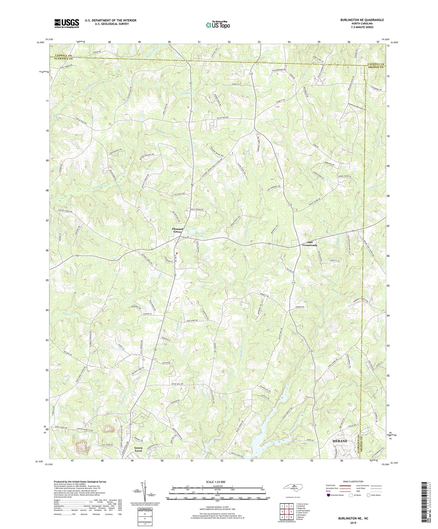
2022 topographic map quadrangle Burlington NE in the state of North Carolina. Scale: 1:24000. Based on the newly updated USGS 7.5' US Topo map series, this map is in the following counties: Alamance, Orange, Caswell. The map contains contour data, water features, and other items you are used to seeing on USGS maps, but also has updated roads and other features. This is the next generation of topographic maps. Printed on high-quality waterproof paper with UV fade-resistant inks.
Quads adjacent to this one:
West: Lake Burlington
Northwest: Cherry Grove
North: Anderson
Northeast: Ridgeville
East: Cedar Grove
Southeast: Efland
South: Mebane
Southwest: Burlington
This map covers the same area as the classic USGS quad with code o36079b3.
Contains the following named places: Cross Roads Church, Frank Creek, Hughes Mill Creek, J R Vinson Lake Dam, Jeffries Cross Church, Just Crossroads, Kimes Chapel, Living Home Church, Longs Chapel, Martins Chapel, McCauley Lake, McCauley Lake Dam, Miles Chapel, Mount Zion Church, North Eastern Alamance Volunteer Fire Department - Pleasant Grove, Occaneechi-Saponi State Designated Tribal Statistical Area, Patillo Church, Pleasant Grove, Pleasant Grove School, Scrub Creek, Snow Hill Church, Stagg Creek, Township 11-Pleasant Grove, Vinsons Lake, White Level Church, ZIP Code: 27302