MyTopo
Ringwood North Carolina US Topo Map
Couldn't load pickup availability
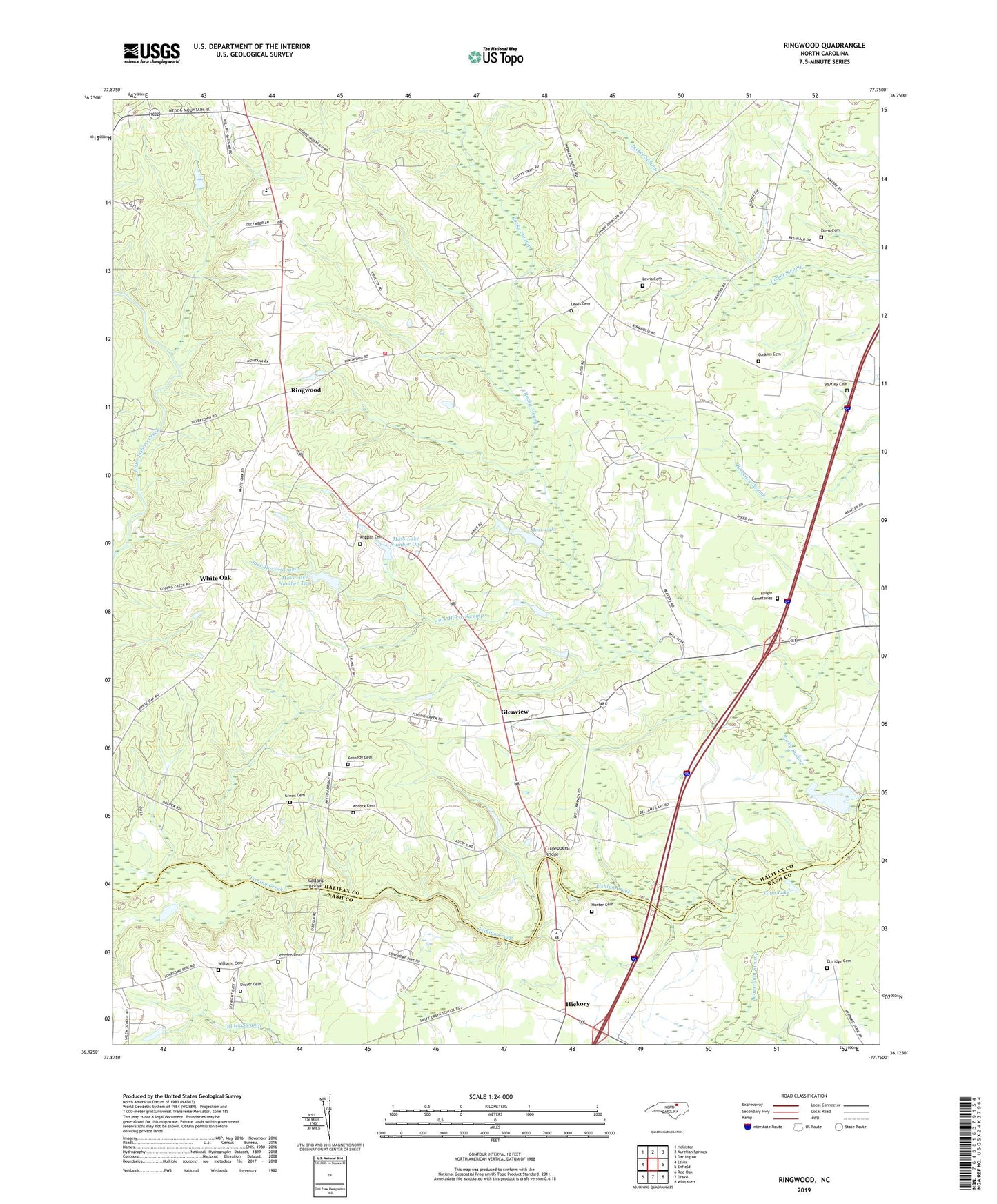
2019 topographic map quadrangle Ringwood in the state of North Carolina. Scale: 1:24000. Based on the newly updated USGS 7.5' US Topo map series, this map is in the following counties: Halifax, Nash. The map contains contour data, water features, and other items you are used to seeing on USGS maps, but also has updated roads and other features. This is the next generation of topographic maps. Printed on high-quality waterproof paper with UV fade-resistant inks.
Quads adjacent to this one:
West: Essex
Northwest: Hollister
North: Aurelian Springs
Northeast: Darlington
East: Enfield
Southeast: Whitakers
South: Drake
Southwest: Red Oak
Contains the following named places: Adcock Cemetery, Beaverdam Swamp, Bellamy Lake, Bellamys Lake Dam, Culpeppers Bridge, Davis Cemetery, Dozier Cemetery, Eastman School, Enfield Fire Department Substation 2, Ethridge Cemetery, Gaskins Cemetery, Glenview, Green Cemetery, Gum Lake, Hickory, Hickory Church, Hunter Cemetery, Jack Horse Swamp, Johnson Cemetery, Kennedy Cemetery, Knight Cemeteries, Lewis Cemetery, Medoc Lookout Tower, Meltons Bridge, Moss Lake, Moss Lake Dam, Moss Lake Number One, Moss Lake Number One Dam, Moss Lake Number Two, Moss Lake Number Two Dam, Plumline Church, Ringwood, Rocky Swamp, Saint Eli Church, Saints Chapel, Turkey Branch Church, Union Church, White Oak, White Oak Elementary School, Whitley Cemetery, Wiggins Cemetery, Williams Cemetery