MyTopo
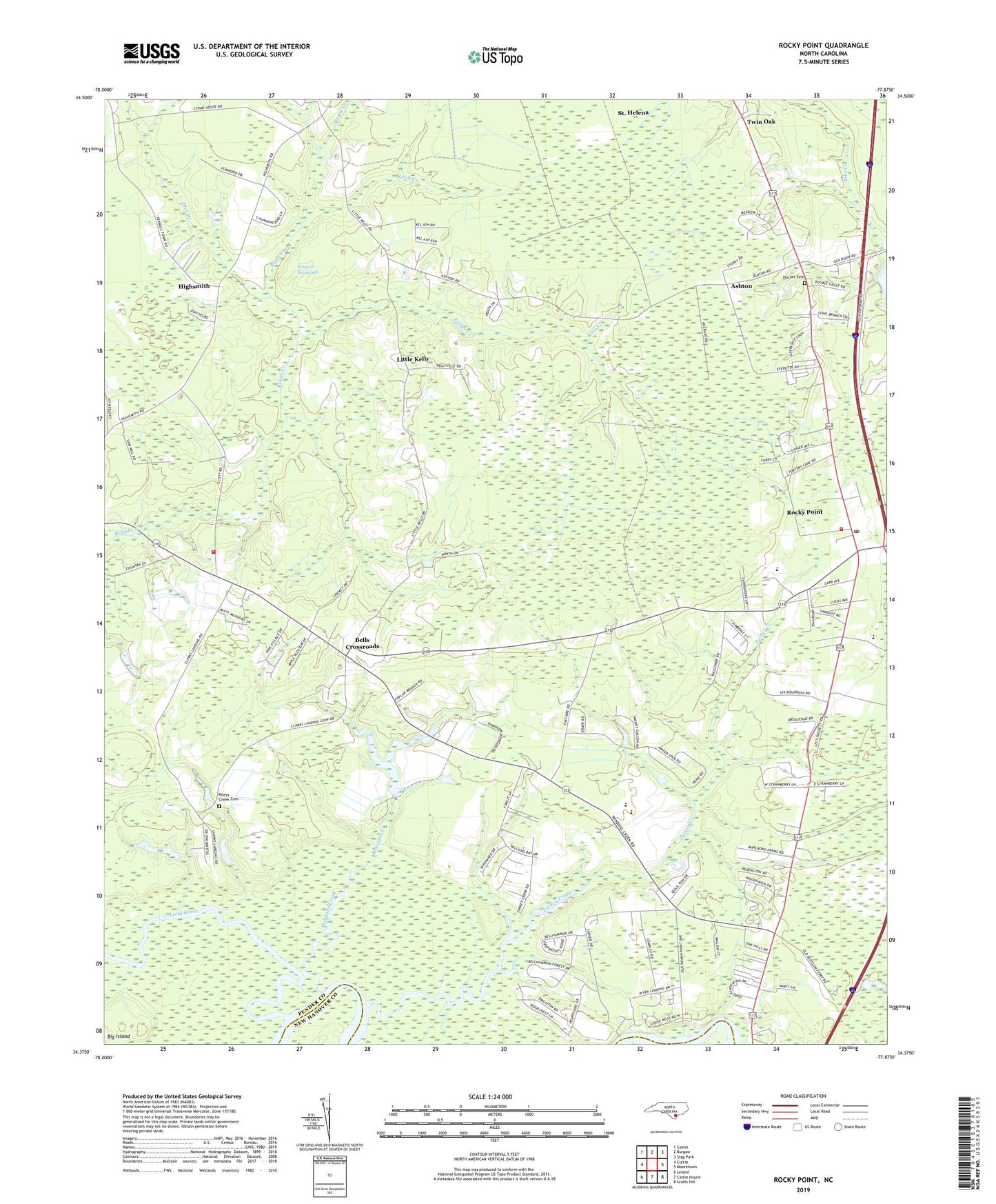
Rocky Point North Carolina US Topo Map
Couldn't load pickup availability
2019 topographic map quadrangle Rocky Point in the state of North Carolina. Scale: 1:24000. Based on the newly updated USGS 7.5' US Topo map series, this map is in the following counties: Pender, New Hanover. The map contains contour data, water features, and other items you are used to seeing on USGS maps, but also has updated roads and other features. This is the next generation of topographic maps. Printed on high-quality waterproof paper with UV fade-resistant inks.
Quads adjacent to this one:
West: Currie
Northwest: Costin
North: Burgaw
Northeast: Stag Park
East: Mooretown
Southeast: Scotts Hill
South: Castle Hayne
Southwest: Leland
Contains the following named places: Antioch Church, Ashton, Bells Crossroads, Birch Creek, Brickhouse Field, Burgaw Savannah, Clarks Landing, Creekside Mobile Home Park, Deerfield Mobile Home Park, Friendship Church, Highsmith, Himobile Mobile Home Park, Hocutt Cemetery, Interstate Mobile Home Park, Kellys Creek, Kimwood Mobile Home Park, Little Kelly, Long Creek, Marlboro, Mill Creek, Morgans Creek, Mount Moriah Church, Pender Academy, Pender EMS and Fire Station Number 21, Pender EMS and Fire Station Number 7, Pike Creek Church, Rileys Creek Cemetery, Rileys Creek Church, Rizzo Creek, Rocky Point, Rocky Point Census Designated Place, Rocky Point Elementary School, Rocky Point Fire Department, Rocky Point Post Office, Ross Creek, Saint Matthews Church, Saint Pauls Church, Tosacal Mobile Home Park, Township of Long Creek, Township of Rocky Point, Turkey Creek, Twin Oak, Twin Oaks Mobile Home Park, ZIP Code: 28457