MyTopo
Moriah North Carolina US Topo Map
Couldn't load pickup availability
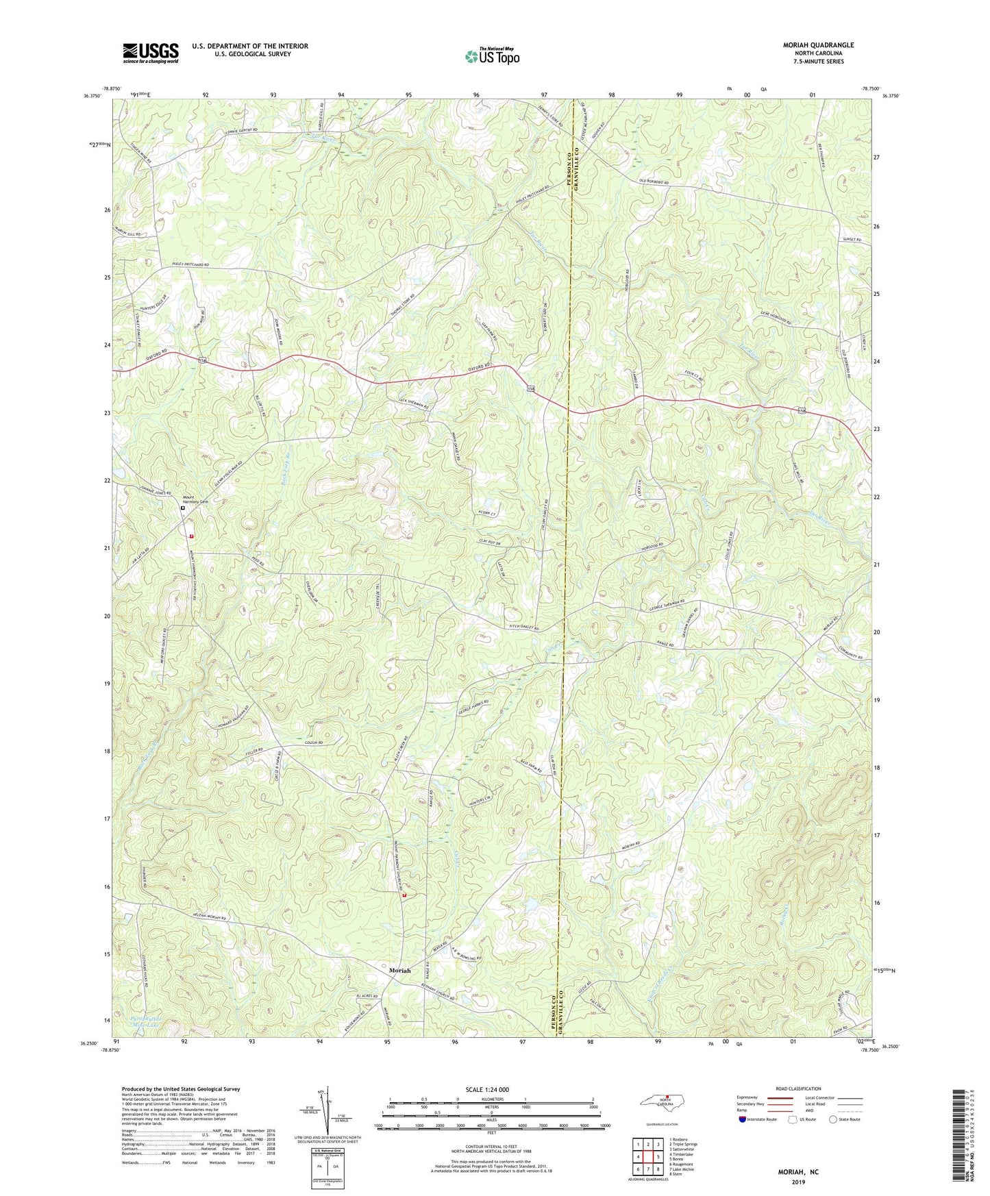
2022 topographic map quadrangle Moriah in the state of North Carolina. Scale: 1:24000. Based on the newly updated USGS 7.5' US Topo map series, this map is in the following counties: Person, Granville. The map contains contour data, water features, and other items you are used to seeing on USGS maps, but also has updated roads and other features. This is the next generation of topographic maps. Printed on high-quality waterproof paper with UV fade-resistant inks.
Quads adjacent to this one:
West: Timberlake
Northwest: Roxboro
North: Triple Springs
Northeast: Satterwhite
East: Berea
Southeast: Stem
South: Lake Michie
Southwest: Rougemont
This map covers the same area as the classic USGS quad with code o36078c7.
Contains the following named places: Bethany Baptist Church, Center Grove School, Cub Creek, Glenns Store, Goshen Chapel, Moriah, Moriah Volunteer Fire and Rescue Headquarters, Moriah Volunteer Fire and Rescue Substation, Mount Harmony Baptist Church, Mount Harmony Cemetery, Mount Tirzah School, New Saint James Church, Oakleys Store, Peeds Store, Piedmont Tech, Pyrophyllite Mine Lake, Saint James School, Siloam Church, Siloam School, Township of Mount Tirzah, Trenton Church, Trinity Church, Uzzles Lake, Uzzles Lake Dam, White Rock Church