MyTopo
Lake Michie North Carolina US Topo Map
Couldn't load pickup availability
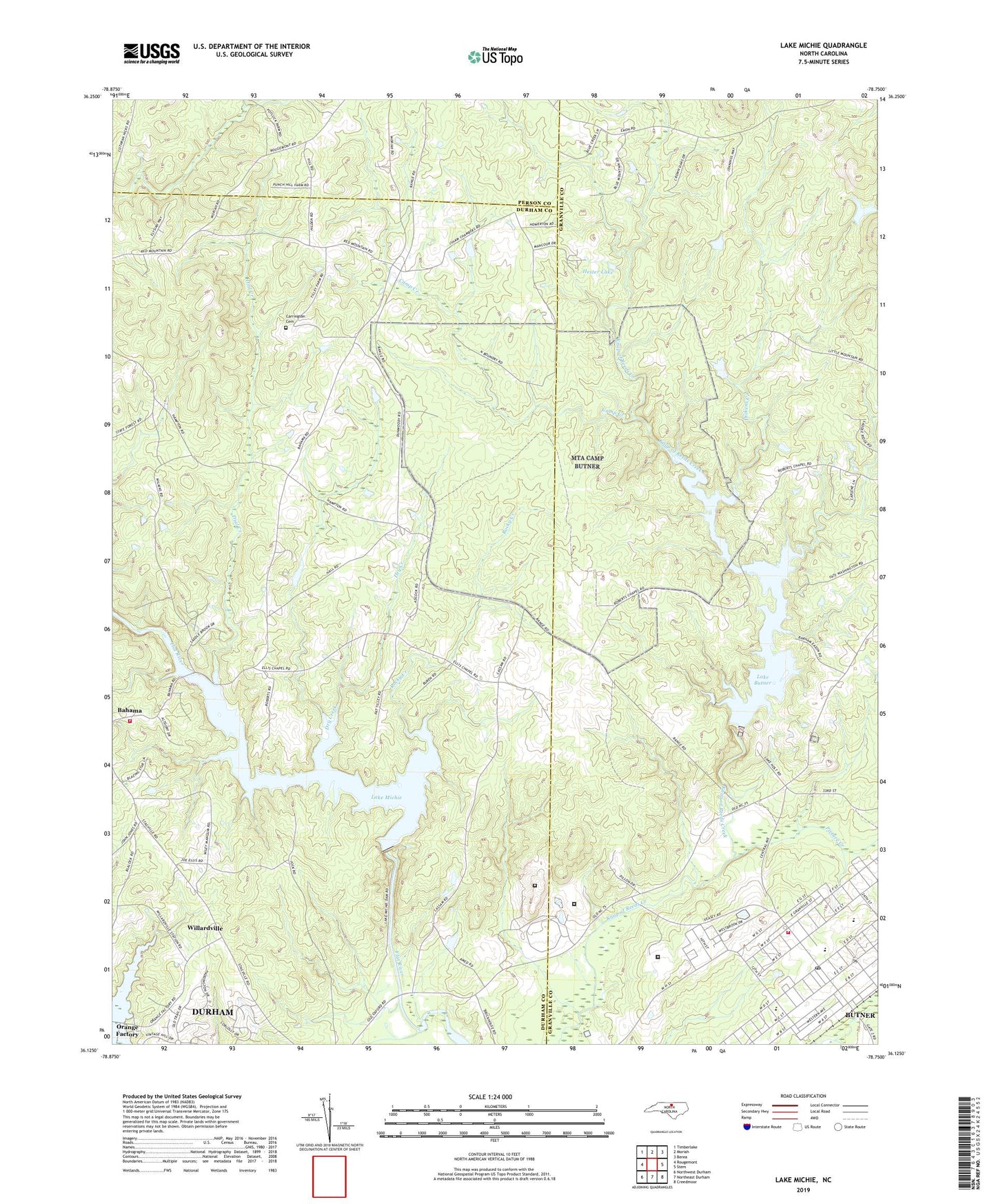
2022 topographic map quadrangle Lake Michie in the state of North Carolina. Scale: 1:24000. Based on the newly updated USGS 7.5' US Topo map series, this map is in the following counties: Granville, Durham, Person. The map contains contour data, water features, and other items you are used to seeing on USGS maps, but also has updated roads and other features. This is the next generation of topographic maps. Printed on high-quality waterproof paper with UV fade-resistant inks.
Quads adjacent to this one:
West: Rougemont
Northwest: Timberlake
North: Moriah
Northeast: Berea
East: Stem
Southeast: Creedmoor
South: Northeast Durham
Southwest: Northwest Durham
This map covers the same area as the classic USGS quad with code o36078b7.
Contains the following named places: Bahama Volunteer Fire Department Station 1, Butner, Butner Census Designated Place, Butner Post Office, Butner Public Safety Fire and Emergency Services, Butner-Stem Central School, Camp Butner Wildlife Management Area, Camp Creek, Camp Murdock, Carrington Cemetery, Dial Creek, Dickens Creek, Dillon School, Dry Creek, Ellis Chapel, Gantt Lake Dam, Hampton, Hester Lake, Hester Lake Number One Dam, Holly Grove Campground, John Umstead Hospital, Knap of Reeds, Lake Butner, Lake Butner Water Supply Dam, Lake Michie Dam, Mangum Store, Mount Calvert Church, Mount Tabor Church, Picture Creek, Polk Correctional Institution, Pyrophyllite Mine Lake Dam, Rocky Creek, Spruce Pine Campground, Town of Butner, Township of Mangum, Willardville