MyTopo
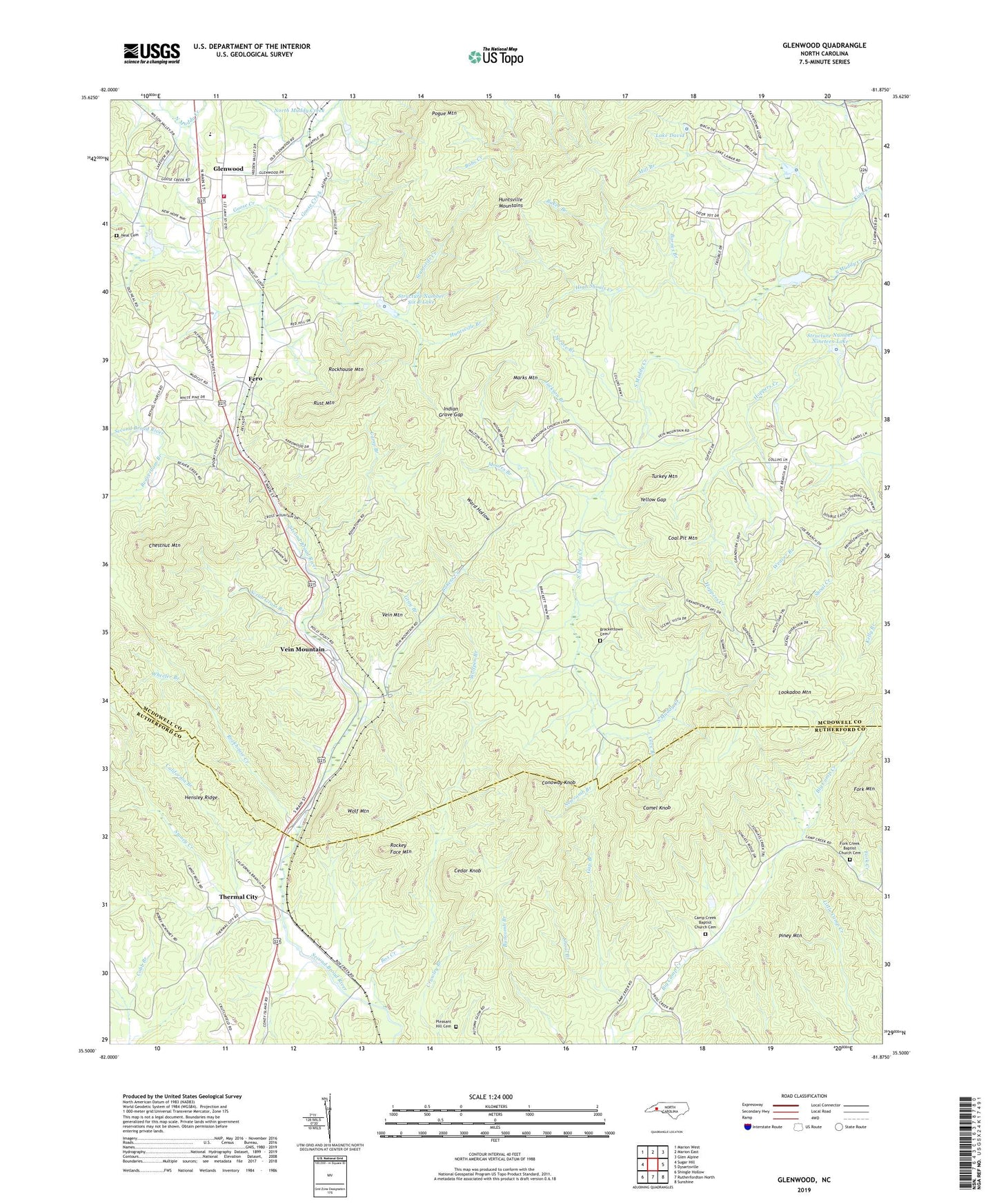
Glenwood North Carolina US Topo Map
Couldn't load pickup availability
2022 topographic map quadrangle Glenwood in the state of North Carolina. Scale: 1:24000. Based on the newly updated USGS 7.5' US Topo map series, this map is in the following counties: McDowell, Rutherford. The map contains contour data, water features, and other items you are used to seeing on USGS maps, but also has updated roads and other features. This is the next generation of topographic maps. Printed on high-quality waterproof paper with UV fade-resistant inks.
Quads adjacent to this one:
West: Sugar Hill
Northwest: Marion West
North: Marion East
Northeast: Glen Alpine
East: Dysartsville
Southeast: Sunshine
South: Rutherfordton North
Southwest: Shingle Hollow
This map covers the same area as the classic USGS quad with code o35081e8.
Contains the following named places: Baker Branch, Bakers Creek, Barnes Branch, Beaverdam Branch, Bethel Church, Box Creek, Brackettown Cemetery, California Branch, Camel Knob, Camp Branch, Camp Creek Baptist Church Cemetery, Camp Creek Church, Cedar Knob, Chestnut Mountain, Coal Pit Mountain, Cobb Branch, Conoway Knob, Cove Branch, Fero, Fork Creek Baptist Church Cemetery, Fork Mountain, Gap Branch, Glenwood, Glenwood Census Designated Place, Glenwood Elementary School, Glenwood Volunteer Fire Department, Goose Creek, Gray Branch, Hensley Ridge, Hicks Branch, High Shoals Creek, Huntsville Branch, Huntsville Mountains, Indian Grave Gap, Jackson Branch, Lake David, Laurel Hill Church, Lookadoo Mountain, Macedonia Church, Marks Mountain, Matt Brooks Dam, Matt Brooks Lake, Mill Branch, Moores Branch, Mount Moriah Church, Neal Cemetery, Newcomb Branch, Piney Mountain, Pleasant Hill Cemetery, Pleasant Hill Church, Pogue Mountain, Rockey Face Mountain, Rockhouse Creek, Rockhouse Mountain, Rust Mountain, Scrub Grass Branch, Shoal Branch, Spruce Branch, Stanfords Creek, Stoney Creek, Structure Number Fifteen Dam, Structure Number Fifteen Lake, Structure Number Nineteen Dam, Structure Number Nineteen Lake, Structure Number Six B Dam, Structure Number Six B Lake, Thermal City, Thermal City Methodist Church, Township of Brackett, Township of Dysartsville, Township of Glenwood, Trio, Turkey Mountain, Vein Mountain, Vein Mountain Church, W W Jones Dam, W W Jones Lake, Ward Hollow, Weaver Branch, Wheeler Branch, Wolf Mountain, Wolfpen Branch, Yellow Gap, ZIP Code: 28167