MyTopo
Shallotte North Carolina US Topo Map
Couldn't load pickup availability
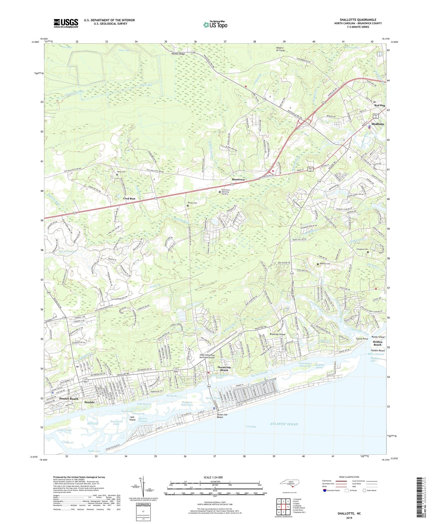
2019 topographic map quadrangle Shallotte in the state of North Carolina. Scale: 1:24000. Based on the newly updated USGS 7.5' US Topo map series, this map is in the following counties: Brunswick. The map contains contour data, water features, and other items you are used to seeing on USGS maps, but also has updated roads and other features. This is the next generation of topographic maps. Printed on high-quality waterproof paper with UV fade-resistant inks.
Quads adjacent to this one:
West: Calabash
Northwest: Freeland
North: Exum
Northeast: Supply
East: Holden Beach
South: Shallotte OE S
Southwest: Little River
Contains the following named places: Abundant Life Church, Apricot Creek, Big Gut Slough, Brantley Island, Brick Landing, Brick Landing Plantation, Brooks Cemetery, Brunswick County Library - Rourk Branch, Brunswick County Regional Emergency Services Training and Operating Facility Headquarters, Brunswick County School, Brunswick Memorial Gardens, Calvary Church, Calvin Point, Camp Church, Cawcaw Bay, Clam Creek, Cool Run, Cooter Creek, Eastern Channel, Gause Landing, Gause Landing Creek, Gold Mine Creek, Goose Creek, Grace Church, Gurganus Cemetery, Head o' Bay, Horse Ford Creek, Hutson Ridge, Jennies Branch, Jennies Branch Baptist Church, Jinks Creek, Jinnys Branch, Kilbart Slough, Lions Paw Golf Links, Little Sauce Pan Creek, Lookout Branch, McMilly Swamp, Mintz Cemetery, Monks Island, Mount Carmel Church, Mulberry Branch, Needham Hole Creek, New Hope Church, Ocean Isle Beach, Ocean Isle Beach Fire Department, Ocean Isle Beach Police Department, Ocean Isle Beach Post Office, Ocean View Church, Odell Williamson Municipal Airport, Old Mill Creek, Pelican Pointe Marina, Piver Bays, Pleasant Hill Church, Register Cemetery, Russtown, Saint Brendian Mission, Saint James Church, Saint Marks Church, Sauce Pan Creek, Saw Pit Swamp, Sea Trail Plantation, Seaside, Shallotte, Shallotte Church, Shallotte Fire Department Station 1, Shallotte Fire Department Station 2, Shallotte Fire Department Station 3, Shallotte Inlet, Shallotte Lookout Tower, Shallotte Point Volunteer Fire Department, Shallotte Police Department, Shallotte Post Office, Shallotte Rescue Squad, Shallotte River, Shallotte Sound, Shallotte Township Park, Shepherd Church, Sols Creek, Sols Island, South Brunswick Post Office, Spring Branch, Still Creek, Summerhomes Mobile Home Park, Sunset Beach Police Department, Town of Ocean Isle Beach, Town of Shallotte, Township of Shallotte, Tubbs Inlet, Union School, Village Point Church, WDZD-FM (Shallotte), West Brunswick High School, Woodward Branch, WVCB-AM (Shallotte), ZIP Codes: 28469, 28470