MyTopo
Freeland North Carolina US Topo Map
Couldn't load pickup availability
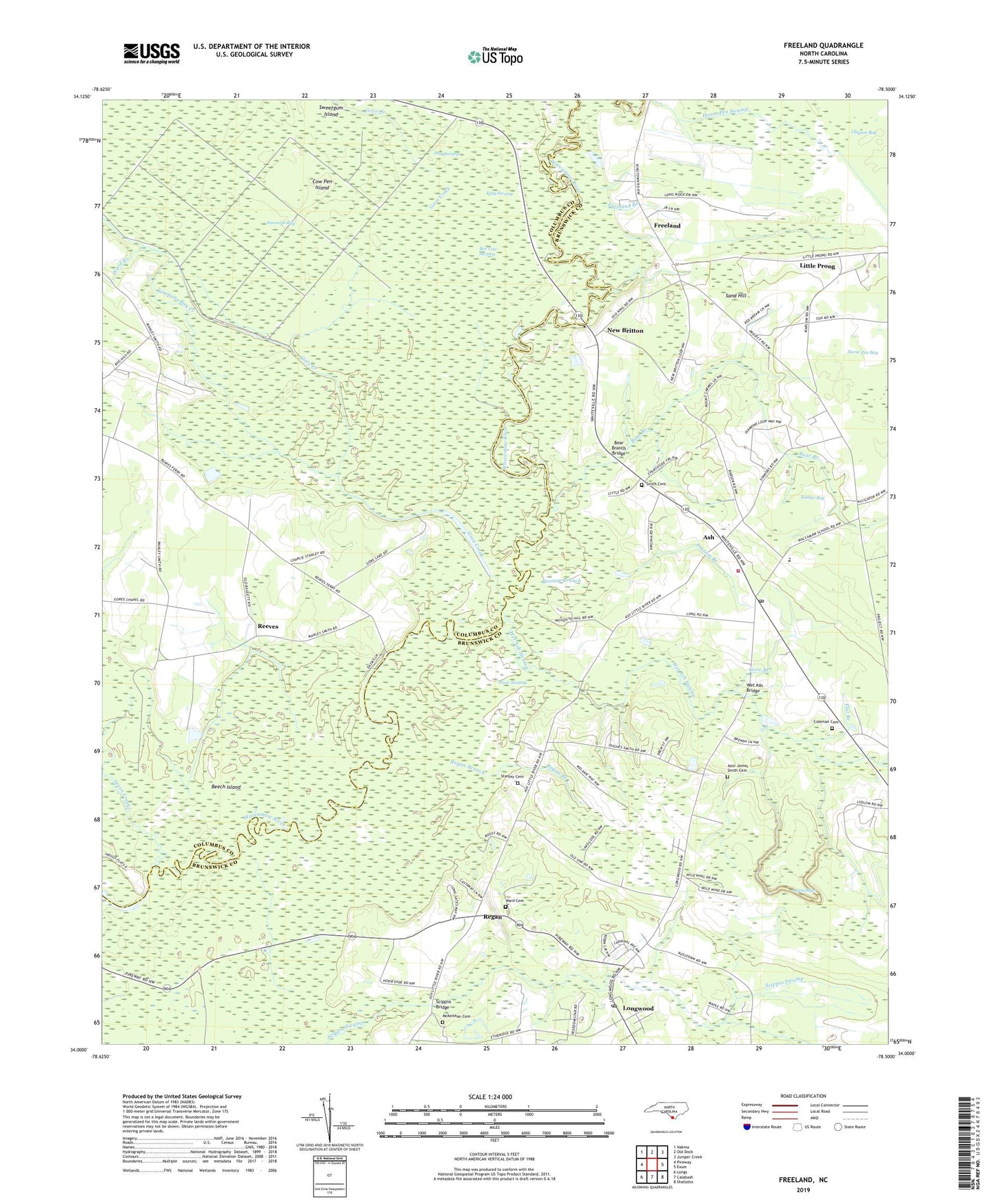
2022 topographic map quadrangle Freeland in the state of North Carolina. Scale: 1:24000. Based on the newly updated USGS 7.5' US Topo map series, this map is in the following counties: Brunswick, Columbus. The map contains contour data, water features, and other items you are used to seeing on USGS maps, but also has updated roads and other features. This is the next generation of topographic maps. Printed on high-quality waterproof paper with UV fade-resistant inks.
Quads adjacent to this one:
West: Pireway
Northwest: Nakina
North: Old Dock
Northeast: Juniper Creek
East: Exum
Southeast: Shallotte
South: Calabash
Southwest: Longs
This map covers the same area as the classic USGS quad with code o34078a5.
Contains the following named places: Ash, Ash Post Office, Azor James Smith Cemetery, Bear Branch, Bear Branch Bridge, Bee Tree Swamp, Beech Island, Bethesda Church, Butler Pond, Clayton Bay, Coleman Cemetery, Cow Pen Island, Flat Branch, Freeland, Freeland Branch, Gore Branch, Gore Chapel, Gore Creek, Gore Lake, Hog Swamp, Horse Pen Swamp, Joe Lake, King Swamp, Little Prong, Long Bays, Longwood, Longwood Church, Longwood Post Office, McKeithan Cemetery, Milliken Swamp, Mount Zion Church, New Brittain Ferry, New Britton, New Britton Church, Possum Branch, Reeves, Regan, Regan Branch, River Swamp, Sand Hill, Scippio Bridge, Seven Creeks, Simmons Bay, Simmons Bay Creek, Smith Cemetery, Soldier Bay, Soldier Bay Church, Stanley Cemetery, Waccamaw, Waccamaw School, Waccamaw Township District Park, Waccamaw Volunteer Fire Department, Ward Branch, Ward Cemetery, Wet Ash Bridge, Wet Ash Swamp