MyTopo
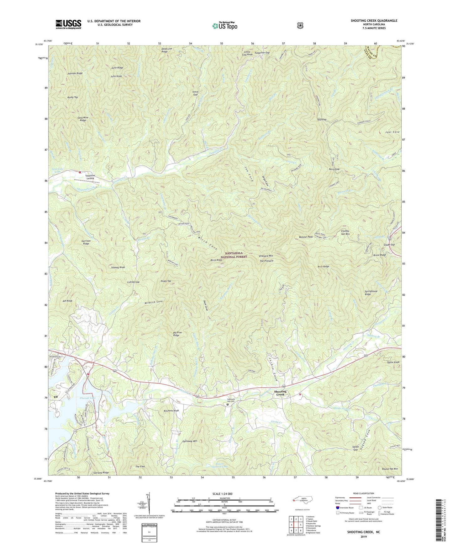
Shooting Creek North Carolina US Topo Map
Couldn't load pickup availability
Also explore the Shooting Creek Forest Service Topo of this same quad for updated USFS data
2022 topographic map quadrangle Shooting Creek in the state of North Carolina. Scale: 1:24000. Based on the newly updated USGS 7.5' US Topo map series, this map is in the following counties: Clay, Macon. The map contains contour data, water features, and other items you are used to seeing on USGS maps, but also has updated roads and other features. This is the next generation of topographic maps. Printed on high-quality waterproof paper with UV fade-resistant inks.
Quads adjacent to this one:
West: Hayesville
Northwest: Andrews
North: Topton
Northeast: Wayah Bald
East: Rainbow Springs
Southeast: Hightower Bald
South: Macedonia
Southwest: Hiawassee
This map covers the same area as the classic USGS quad with code o35083a6.
Contains the following named places: Arch Ridge, Ash Knob, Bethabara Church, Bethel Church, Big Pine Ridge, Big Tuni Creek, Birch Cove, Birch Knob, Bluff Branch, Boteler Peak, Bruce Ridge, Burch Cove Branch, Chairmaker Branch, Chestnut Branch, Chunky Gal Mountain, Church Branch, Clay County Fire and Rescue Station 2, Clay County Fire and Rescue Station 4, Cold Branch, Compass Creek, Copper Mine Branch, Dark Cove, Dave Barrett Creek, Eagle Fork Church, Eagle Fork Creek, Elf, Fishprong Branch, Galloway Hill Cemetery, Galloway Mountain, Garland Ridge, Garrison Ridge, Giesky Creek, Glade Gap, Gold Mine Ridge, Hogsed Cove, Hothouse Branch, Hurricane Creek, Jackie Cove, Joe Cove, Julie Branch, Julie Knob, Kitchens Knob, Laurel Branch, Ledford Creek, Licklog Gap, Little Clay Knob, Little Tuni Creek, Locust Log Branch, Long Branch, Lynch Branch, Marshall Chapel, Matlock Creek, Milksick Cove, Mill Creek, Mission Hill Church, Moore Branch, Morgan Branch, Moss Branch, Mull Branch, Muskrat Branch, Nattie Branch, Neal Cabe Dam, Neal Cabe Lake, Needmore Branch, Old Shooting Creek Church, Passmore Branch, Penland Branch, Perry Creek, Perry Gap, Piney Top, Pounding Mill Creek, Rocking Chair Branch, Rocky Top, Round Top Mountain, Salley Gap, Sapsucker Branch, Shooting Creek, Shooting Creek School, Shooting Creek Volunteer Fire Department, Springhouse Ridge, Stamey Knob, Steve Branch, Steve Gap, Stillhouse Branch, Sunday Branch, Tate Branch, Tate Gap, Taylor Knob, The Flea, The Pinnacle, Thompson Creek, Thumping Creek, Thunderstruck Branch, Township of Shooting Creek, Township of Tusquittee, Tusquitee Church, Tusquitee Gap, Tusquittee Landing, Union Chapel, Vineyard Creek, Vineyard Mountain, Virge Cove, Wilson Shepard Dam, Wilson Shepard Lake, ZIP Code: 28904