MyTopo
Snow Camp North Carolina US Topo Map
Couldn't load pickup availability
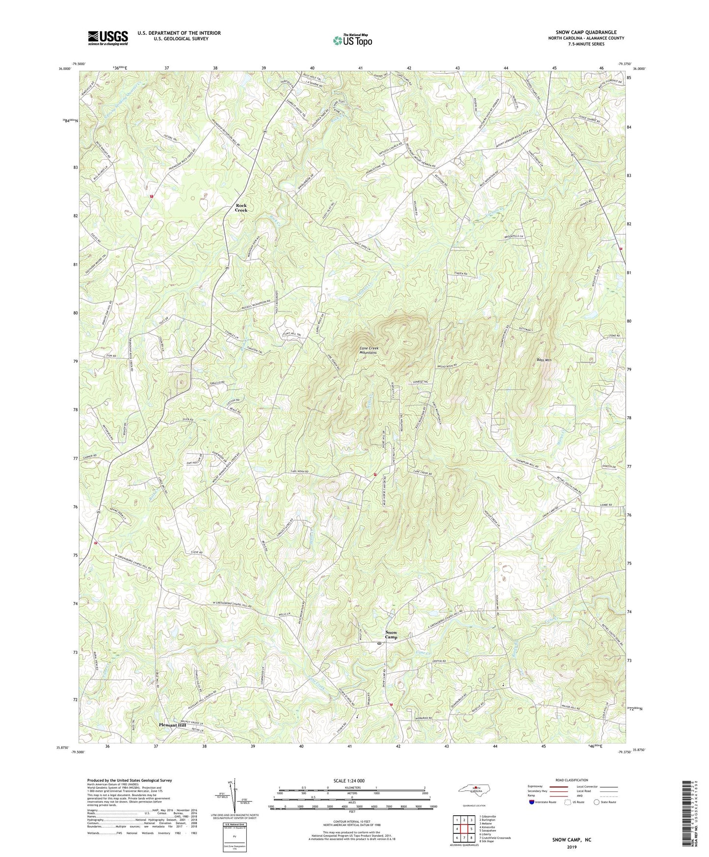
2019 topographic map quadrangle Snow Camp in the state of North Carolina. Scale: 1:24000. Based on the newly updated USGS 7.5' US Topo map series, this map is in the following counties: Alamance. The map contains contour data, water features, and other items you are used to seeing on USGS maps, but also has updated roads and other features. This is the next generation of topographic maps. Printed on high-quality waterproof paper with UV fade-resistant inks.
Quads adjacent to this one:
West: Kimesville
Northwest: Gibsonville
North: Burlington
Northeast: Mebane
East: Saxapahaw
Southeast: Silk Hope
South: Crutchfield Crossroads
Southwest: Liberty
Contains the following named places: Antioch Church, Bass Mountain, Bethel Church, Camp Frontier, Cane Creek Church, Cane Creek Mountains, Cane Creek School, E M Holt Volunteer Fire Department Substation Station 19, Eli Whitney Volunteer Fire Department Station 11, Friendship Church, Hico Church, Mount Hermon Church, Mount Pleasant Church, Reedy Branch, Rock Creek, Rock Creek Church, Snow Camp, Snow Camp Post Office, Snow Camp Volunteer Fire Department Station 14, Snow Camp Volunteer Fire Department Station 16, Snow Camp Volunteer Fire Department Station 6, Sylvan School, Township 1-Patterson, Township 7-Albright, Victory Chapel, Wells Creek, Woods Chapel, WPCM-FM (Burlington), ZIP Code: 27349