MyTopo
Stanfield North Carolina US Topo Map
Couldn't load pickup availability
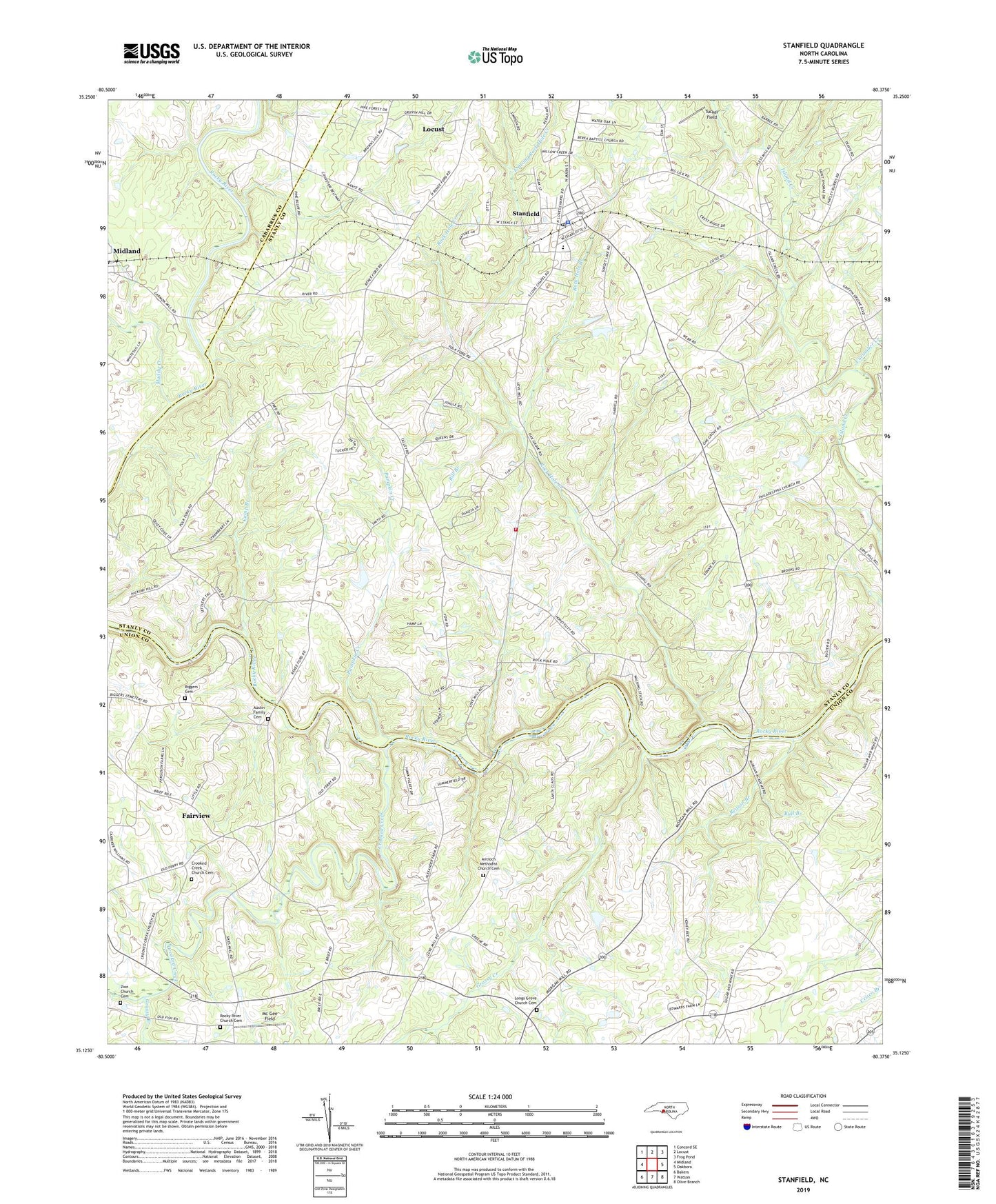
2019 topographic map quadrangle Stanfield in the state of North Carolina. Scale: 1:24000. Based on the newly updated USGS 7.5' US Topo map series, this map is in the following counties: Stanly, Union, Cabarrus. The map contains contour data, water features, and other items you are used to seeing on USGS maps, but also has updated roads and other features. This is the next generation of topographic maps. Printed on high-quality waterproof paper with UV fade-resistant inks.
Quads adjacent to this one:
West: Midland
Northwest: Concord SE
North: Locust
Northeast: Frog Pond
East: Oakboro
Southeast: Olive Branch
South: Watson
Southwest: Bakers
Contains the following named places: Antioch Church, Antioch Methodist Church Cemetery, Austin Family Cemetery, Biggers Cemetery, Bill Branch, Bull Branch, Camp Branch, Coyl Church, Crooked Creek, Crooked Creek Church, Crooked Creek Church Cemetery, Cucumber Creek, East Prong Rock Hole Creek, Friendship Church, Grassy Branch, Grassy Creek, Indian Hill Church, Kinza Memorial Church, Longs Grove Church, Longs Grove Church Cemetery, Loves Chapel, Loves Grove Church, Mc Gee Field, Morgans Memorial Church, Muddy Creek, Philadelphia Church, Pumpkin Creek, Reason Branch, Rock Hole Branch, Rock Hole Creek, Rocky River Church Cemetery, Rocky River Volunteer Fire Department, Stanfield, Stanfield Police Department, Stanfield Post Office, Stanfield School, Sunset Lake, Sunset Lake Dam Number One, Town of Stanfield, Township of Furr, Tucker Field, Zion Church, Zion Church Cemetery, ZIP Code: 28163