MyTopo
Olive Branch North Carolina US Topo Map
Couldn't load pickup availability
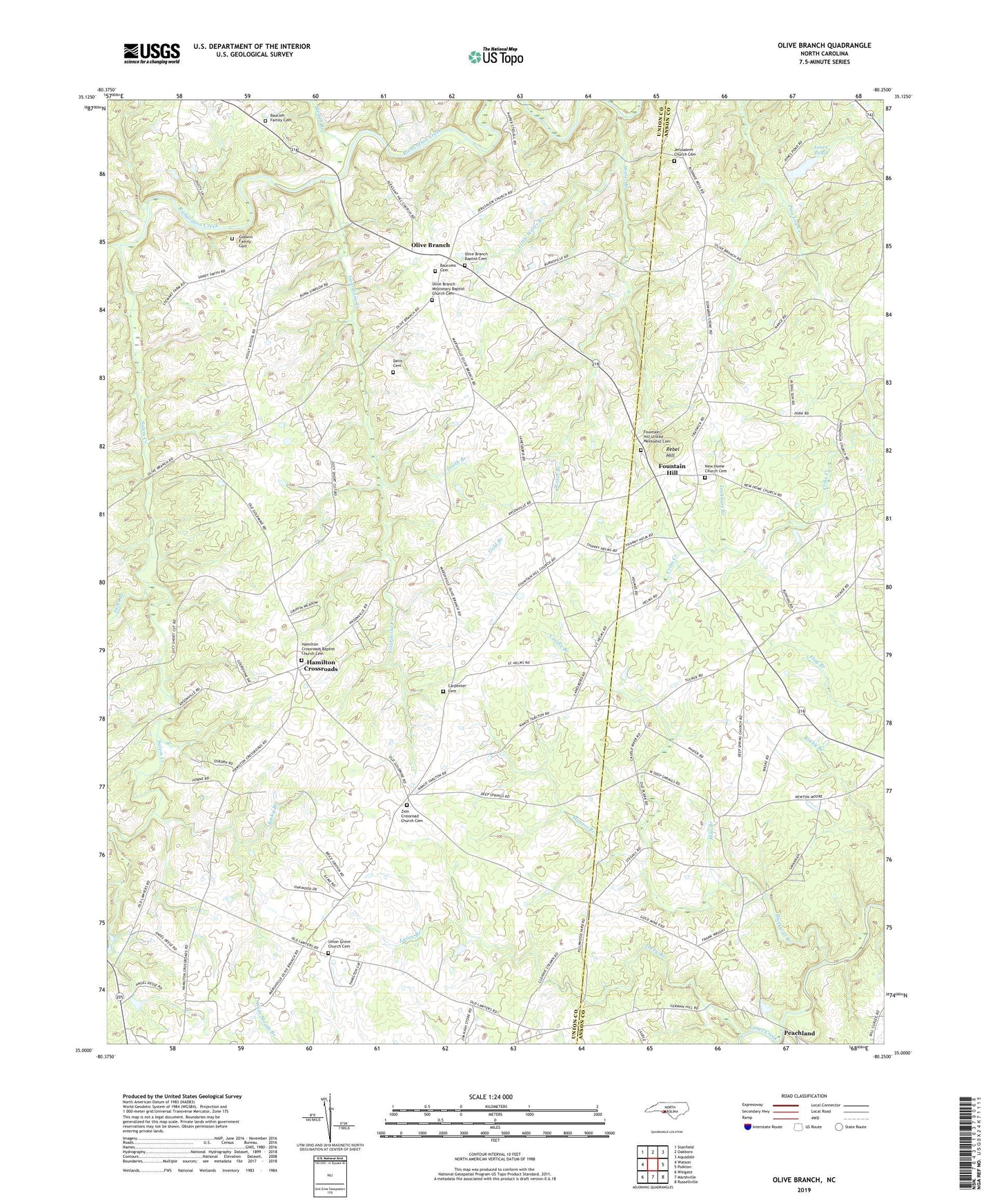
2022 topographic map quadrangle Olive Branch in the state of North Carolina. Scale: 1:24000. Based on the newly updated USGS 7.5' US Topo map series, this map is in the following counties: Union, Anson. The map contains contour data, water features, and other items you are used to seeing on USGS maps, but also has updated roads and other features. This is the next generation of topographic maps. Printed on high-quality waterproof paper with UV fade-resistant inks.
Quads adjacent to this one:
West: Watson
Northwest: Stanfield
North: Oakboro
Northeast: Aquadale
East: Polkton
Southeast: Russellville
South: Marshville
Southwest: Wingate
This map covers the same area as the classic USGS quad with code o35080a3.
Contains the following named places: Baucom Family Cemetery, Baucoms Cemetery, Becky Branch, Blackwell Branch, Cappadocia Church, Carpenter Cemetery, Caudle Branch, Davis Cemetery, Deep Spring Church, Fountain Hill, Fountain Hill United Methodist Cemetery, Godwin Family Cemetery, Gold Branch, Gourdvine Creek, Hamilton Crossroads, Hamilton Crossroads Baptist Church Cemetery, Harmony Community Church, Jacks Branch, Jerusalem Church, Jerusalem Church Cemetery, Jones Pond, Jones Pond Dam, Lacey Branch, Little Water Branch, Lockhart Branch, Maness Branch, Mile Branch, New Home Church, New Home Church Cemetery, Olive Branch, Olive Branch Baptist Cemetery, Olive Branch Missionary Baptist Church Cemetery, Rebel Hill, Salem Creek, Smith Branch, Stegall Branch, Township of New Salem, Union Emergency Medical Services, Union Grove Church, Union Grove Church Cemetery, Water Branch, Zion Crossroad Church, Zion Crossroad Church Cemetery