MyTopo
Central North Carolina US Topo Map
Couldn't load pickup availability
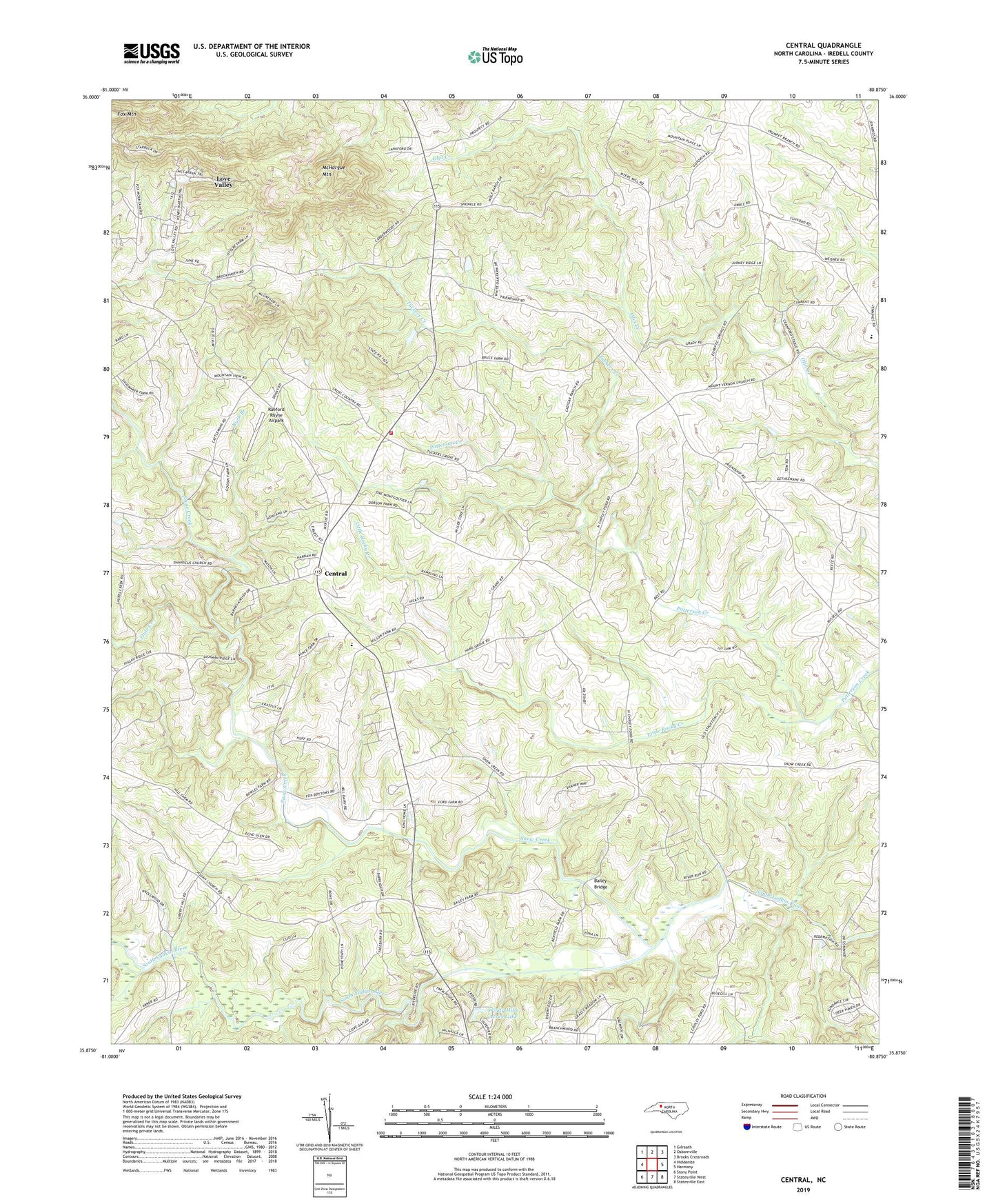
2022 topographic map quadrangle Central in the state of North Carolina. Scale: 1:24000. Based on the newly updated USGS 7.5' US Topo map series, this map is in the following counties: Iredell. The map contains contour data, water features, and other items you are used to seeing on USGS maps, but also has updated roads and other features. This is the next generation of topographic maps. Printed on high-quality waterproof paper with UV fade-resistant inks.
Quads adjacent to this one:
West: Hiddenite
Northwest: Gilreath
North: Osbornville
Northeast: Brooks Crossroads
East: Harmony
Southeast: Statesville East
South: Statesville West
Southwest: Stony Point
This map covers the same area as the classic USGS quad with code o35080h8.
Contains the following named places: Bailey Bridge, Bailey Hills, Buck Branch, Central, Central Elementary School, Central Volunteer Fire Department, Clio Church, Damascus Church, Dobson Dairy Farm, Dripoff Branch, Fox Mountain, Friendship Church, Hams Grove Church, Keaton Grove Church, Little Rocky Creek, Love Valley, McHargue Mountain, Mount Vernon Church, Mountain View Church, New Prospect Church, Outz Creek, Pleasant Grove Church, Prospect Branch, Raeford Rhyne Airpark, Rocky Hill Church, Sandy Ridge Church, Sharp, Snow Creek, Snow Creek Methodist Church, Town of Love Valley, Township of Sharpesburg, Tuckers Creek, Wilson Godfrey Dam, Windy Hill Acres Lake Dam, Windy Hills Acres Lake