MyTopo
Waco North Carolina US Topo Map
Couldn't load pickup availability
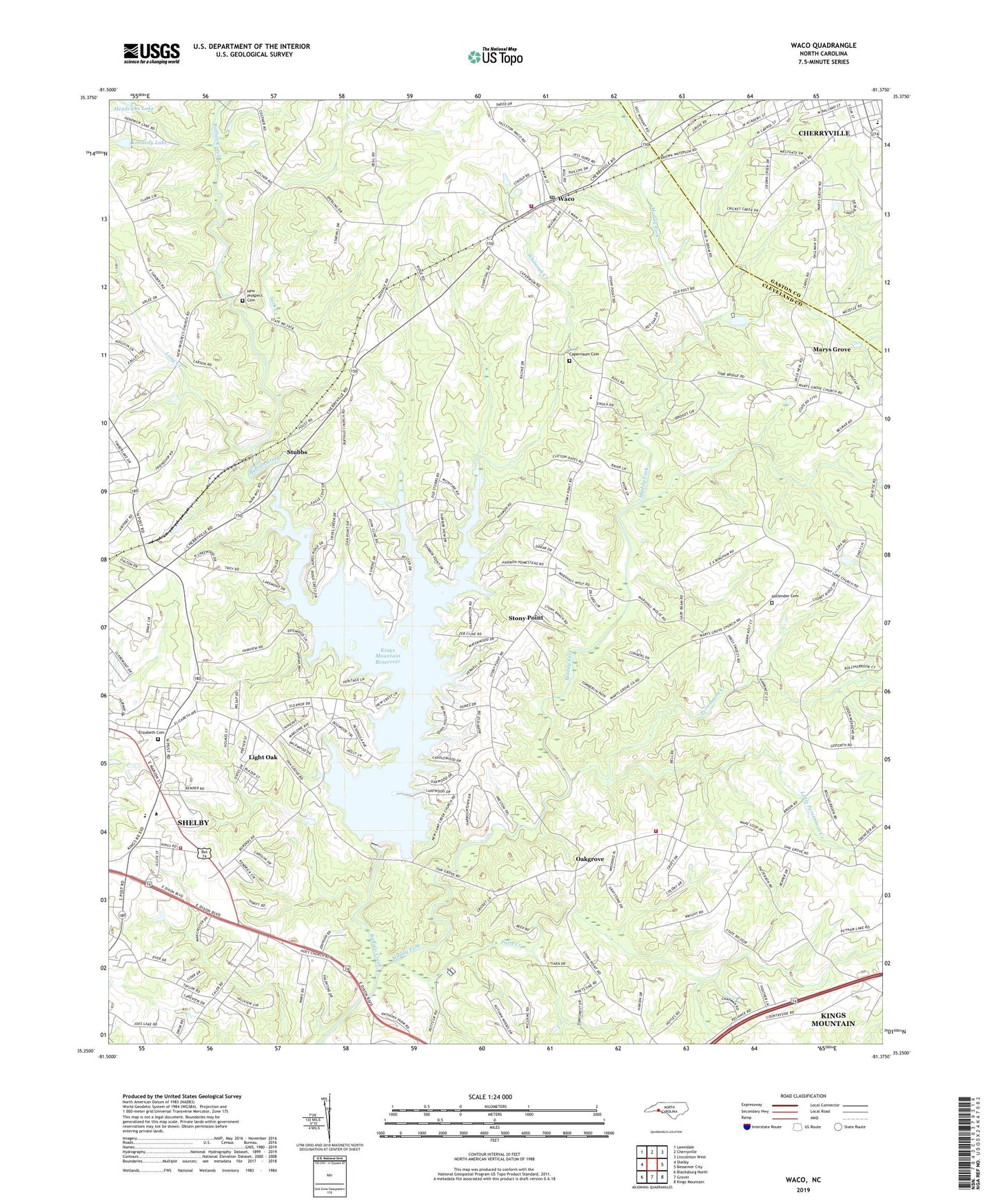
2022 topographic map quadrangle Waco in the state of North Carolina. Scale: 1:24000. Based on the newly updated USGS 7.5' US Topo map series, this map is in the following counties: Cleveland, Gaston. The map contains contour data, water features, and other items you are used to seeing on USGS maps, but also has updated roads and other features. This is the next generation of topographic maps. Printed on high-quality waterproof paper with UV fade-resistant inks.
Quads adjacent to this one:
West: Shelby
Northwest: Lawndale
North: Cherryville
Northeast: Lincolnton West
East: Bessemer City
Southeast: Kings Mountain
South: Grover
This map covers the same area as the classic USGS quad with code o35081c4.
Contains the following named places: Beam School, Beulah Church, Buffalo Church, Capernaum Baptist Church, Capernaum Cemetery, Cleveland Community College Emergency Services Regional Training Center, Cleveland County Emergency Medical Services, Cleveland County Emergency Medical Services Station 8, Cleveland County Fairgrounds, Cleveland County Home, Cleveland County Office Building, Cleveland County Technical Institute, Cleveland Mall, Cleveland Spring, Crossroads Music Park, Elizabeth Cemetery, Elizabeth Church, Elizabeth City, Elizabeth School, Emmanuel Church, Fairview Farms, Fancy, First Assembly of God Church, Friendship Chapel, Hendricks Lake, Hendricks Lake Dam, Holbrook, Holy Memorial Church, Hullender Cemetery, Jerusalem Church, Kennedy Lake, Kennedy Lake Dam, Kings Mountain Reservoir, Landsdown, Light Oak, Light Oak Census Designated Place, Light Oak Church, Little Persimmon Creek, Long Creek, Marys Grove, Marys Grove Church, Masonic Lodge, Mays Church, Moss Dam, Moss Lake, Muddy Fork, New Camp Creek Church, New Prospect, New Prospect Cemetery, New Prospect Church, North Carolina State Highway Department, North Carolina State Highway Patrol Troop H District 4, Oak Grove Baptist Church, Oak Grove Volunteer Fire Department, Oakgrove, Persimmon Creek, Plank School, Potts Creek, Rhyne School, Roberts School, Rock Cut School, Saint Luke Church, Shelby Fire Department Kings Road Station, South School, Stony Point, Stubbs, Suck Creek, Town of Waco, Waco, Waco Baptist Church, Waco Community Volunteer Fire Department, Waco High School, Waco Post Office, Ware Bridge, Warlick Township 5, Washington Church, Washington School, Whiteoak Creek, Woodbridge, Woodbridge Golf Course, ZIP Code: 28169